Latitude: 51.601 / 51°36'3"N
Longitude: -1.1227 / 1°7'21"W
OS Eastings: 460856
OS Northings: 189490
OS Grid: SU608894
Mapcode National: GBR 911.JZP
Mapcode Global: VHCYP.H190
Plus Code: 9C3WJV2G+9W
Entry Name: 12, High Street
Listing Date: 17 March 1970
Last Amended: 9 February 1988
Grade: II
Source: Historic England
Source ID: 1368511
English Heritage Legacy ID: 249260
ID on this website: 101368511
Location: Wallingford, South Oxfordshire, OX10
County: Oxfordshire
District: South Oxfordshire
Civil Parish: Wallingford
Built-Up Area: Wallingford
Traditional County: Berkshire
Lieutenancy Area (Ceremonial County): Oxfordshire
Tagged with: Architectural structure
This list entry was subject to a Minor Amendment on 18 August 2025 to update the Name and Address and reformat the text to current standards
SU6089SE
11/96
WALLINGFORD
Wallingford
HIGH STREET (South side)
No 12
(Formerly listed as No.12 (Wallingford Stamp Centre and Ye Olde Bakery), previously listed as No. 12 (Hedges))
17/03/70
GV
II
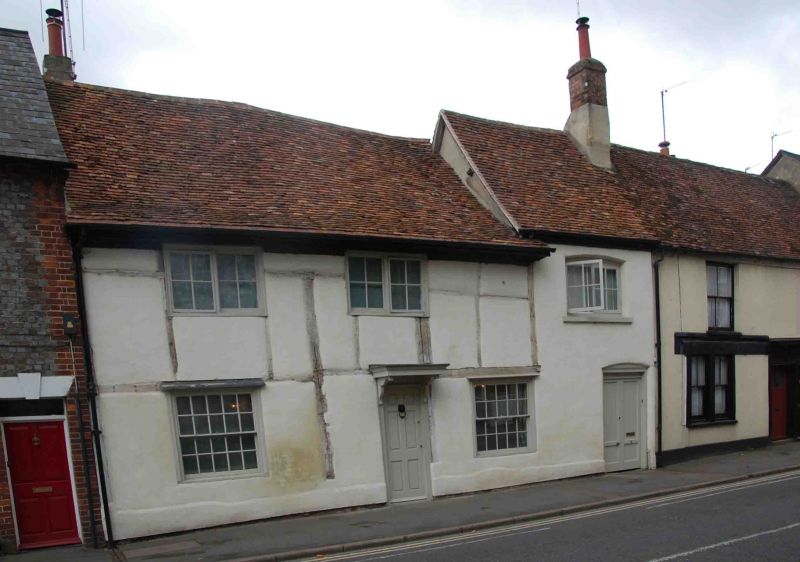
Shops and dwellings. C17 with later addition to right. Rendered plinth; lined render, probably on timber framing; old plain-tile roof; brick end stacks; Two-storey, three-window range. C19 shop front to centre with C20 part-glazed door to left of centre. Panelled double doors to carriage-way arch to right. 20-pane unhorned sash with painted wood architrave surround to left. Two-light casements to first floor. Roof to right higher than that to centre and left.
Timber framing visible to interior.
Listing NGR: SU6085689490
External links are from the relevant listing authority and, where applicable, Wikidata. Wikidata IDs may be related buildings as well as this specific building. If you want to add or update a link, you will need to do so by editing the Wikidata entry.


Other nearby listed buildings