Latitude: 51.5882 / 51°35'17"N
Longitude: -1.4294 / 1°25'45"W
OS Eastings: 439625
OS Northings: 187864
OS Grid: SU396878
Mapcode National: GBR 6Y5.CF2
Mapcode Global: VHC12.5BNS
Plus Code: 9C3WHHQC+76
Entry Name: Priors Hold
Listing Date: 22 April 1950
Grade: II
Source: Historic England
Source ID: 1368490
English Heritage Legacy ID: 251257
ID on this website: 101368490
Location: Wantage, Vale of White Horse, Oxfordshire, OX12
County: Oxfordshire
District: Vale of White Horse
Civil Parish: Wantage
Built-Up Area: Wantage
Traditional County: Berkshire
Lieutenancy Area (Ceremonial County): Oxfordshire
Tagged with: Architectural structure
WANTAGE PRIORY ROAD SU3987NE 9/158 Priors Hold 22/04/50
GV II
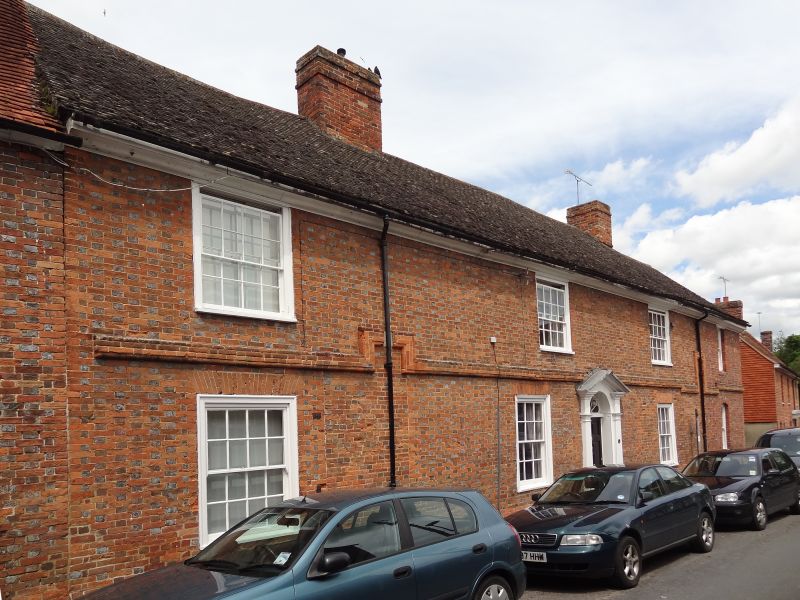
House. Late C17, extended one bay to right in mid C19. Flemish bond brick with flared headers, C20 tile roof; brick stacks. 4-unit plan. 2 storeys; 4-window range. Pedimented surround broken by fanlight to 6-panelled door. Gauged brick flat arches over sashes; timber lintel and segmental header arch over mid C19 horned sashes to right bay. Moulded brick string course. Gabled roof; ridge stacks. 2 roughcast wings with gabled C20 tile roofs to rear. Interior not inspected but noted as having panelled rooms.
Listing NGR: SU3962587864
External links are from the relevant listing authority and, where applicable, Wikidata. Wikidata IDs may be related buildings as well as this specific building. If you want to add or update a link, you will need to do so by editing the Wikidata entry.


Other nearby listed buildings