Latitude: 51.5995 / 51°35'58"N
Longitude: -1.1245 / 1°7'28"W
OS Eastings: 460736
OS Northings: 189322
OS Grid: SU607893
Mapcode National: GBR 911.QHV
Mapcode Global: VHCYP.G2D5
Plus Code: 9C3WHVXG+Q6
Entry Name: Wool House
Listing Date: 9 February 1988
Grade: II
Source: Historic England
Source ID: 1368481
English Heritage Legacy ID: 249308
ID on this website: 101368481
Location: Wallingford, South Oxfordshire, OX10
County: Oxfordshire
District: South Oxfordshire
Civil Parish: Wallingford
Built-Up Area: Wallingford
Traditional County: Berkshire
Lieutenancy Area (Ceremonial County): Oxfordshire
Tagged with: House
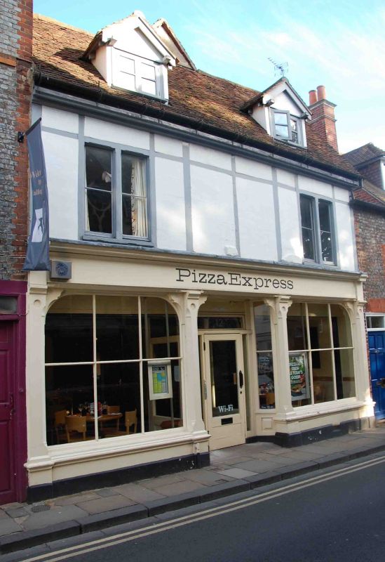
WALLINGFORD ST. MARY'S STREET SU6089SE (East side) Wallingford 11/141 Nos.12 and 13 (Wool House)
GV II
House, now shop. Mid C17 with late C19 front and addition to rear, C20 alterations to ground floor. Render, probably on brick to plinth; late C19 light timber framing, probably on earlier timber framing, with lined render infill; old plain-tile roof. 2-storey, 2-window range. Late C19 shop front to ground floor with C20 glazed door to central recessed porch. 2-light wood mullion windows to first floor left and right. C20 staircase from ground to first floor. Winder staircase from first floor to attic. Coupled rafter roof with probably aid C17 roof trusses and purlins. Extensive beaming to first floor and attic. Former Penny Bank to right, now part of shop. Early C19, with C20 alterations. Grey brick with red brick dressings; Welsh slate hipped roof. 2-storey, single-window range. Blocked doorway with C20 window to left. Tall Venetian window with unhorned sashes having Gothick glazing bars and cambered rubbed brick head to right.
Listing NGR: SU6073689322
External links are from the relevant listing authority and, where applicable, Wikidata. Wikidata IDs may be related buildings as well as this specific building. If you want to add or update a link, you will need to do so by editing the Wikidata entry.


Other nearby listed buildings