Latitude: 52.6373 / 52°38'14"N
Longitude: -2.853 / 2°51'10"W
OS Eastings: 342374
OS Northings: 304741
OS Grid: SJ423047
Mapcode National: GBR BD.6VPJ
Mapcode Global: WH8BZ.4ZQ0
Plus Code: 9C4VJ4PW+WR
Entry Name: Lower Oaks
Listing Date: 10 March 1986
Grade: II
Source: Historic England
Source ID: 1366678
English Heritage Legacy ID: 259521
ID on this website: 101366678
Location: Oaks, Shropshire, SY5
County: Shropshire
Civil Parish: Longden
Traditional County: Shropshire
Lieutenancy Area (Ceremonial County): Shropshire
Church of England Parish: Longden and Annscroft
Church of England Diocese: Hereford
Tagged with: Architectural structure
SJ 40 SW PONTESBURY C.P. OAKS
8/217 Lower Oaks -
- II
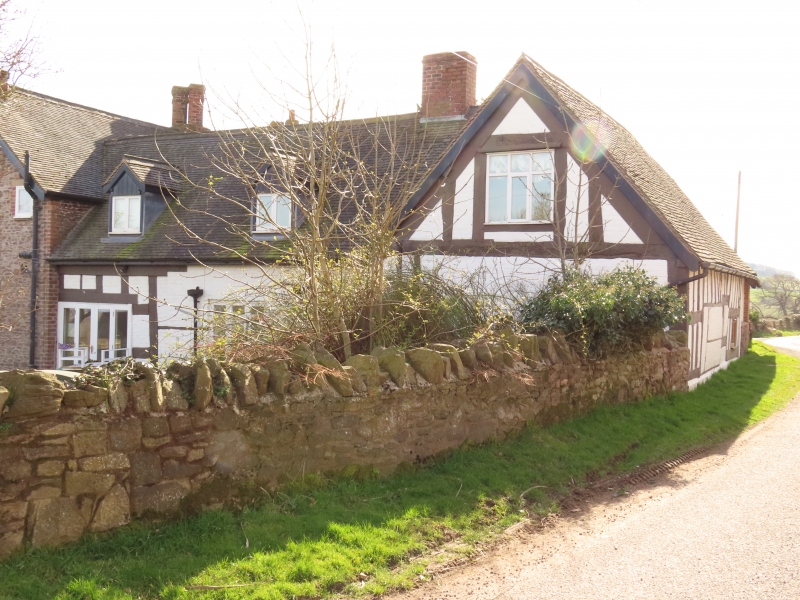
Farmhouse. Probably C15 extended c.1600 and again in 1873 (datestone). Timber framed, partly of cruck construction, with painted brick infill and cladding, machine tile roof. Former open hall of 2 cruck-framed bays with 2-bay cross- wing added to west end c.1600; 2-storey triple-gabled stone wing of 1873 to east. One storey and attic; framing: mainly brick clad but 3 square panels from cill to wall-plate exposed at east end of hall (north side), close studding to west wall of cross-wing; irregular fenestration, two C20 casements to left and one 3-light fixed-light window to centre of hall range with two C20 gabled dormers above in roof slope; one late C19 casement on first floor and one fixed-light window with boarded door to left on ground floor of cross- wing; entrance through boarded door on south with red brick axial ridge stack immediately to left. Interior: parts of both cruck trusses visible on first floor. Range of 1873 not of special architectural interest. V.C.H. VIII (1968), p.262.
Listing NGR: SJ4237404741
External links are from the relevant listing authority and, where applicable, Wikidata. Wikidata IDs may be related buildings as well as this specific building. If you want to add or update a link, you will need to do so by editing the Wikidata entry.


Other nearby listed buildings