Latitude: 54.8329 / 54°49'58"N
Longitude: -2.9829 / 2°58'58"W
OS Eastings: 336963
OS Northings: 549112
OS Grid: NY369491
Mapcode National: GBR 7DMK.0B
Mapcode Global: WH808.4SVF
Plus Code: 9C6VR2M8+4V
Entry Name: Dalston Bridge
Listing Date: 19 September 1984
Grade: II
Source: Historic England
Source ID: 1366595
English Heritage Legacy ID: 78313
ID on this website: 101366595
Location: Buckabank, Cumberland, Cumbria, CA5
County: Cumberland
District: Carlisle
Civil Parish: Dalston
Traditional County: Cumberland
Lieutenancy Area (Ceremonial County): Cumbria
Church of England Parish: Dalston St Michael
Church of England Diocese: Carlisle
Tagged with: Bridge
NY 34 NE DALSTON Dalston
10/127 Dalston Bridge
II
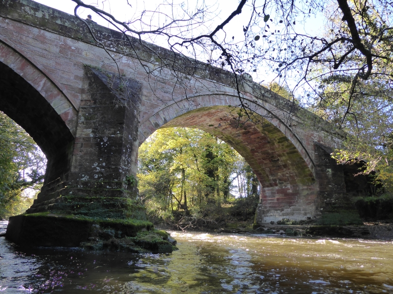
Roadbridge over the River Caldew. Dated 1812 with inscription UNION BRIDGE on central parapet stones. Snecked red sandstone ashlar. 3 segmental arches on pointed cutwaters. String course under solid parapet: oval inscription stones on either side. Named Dalston Bridge on O.S. map.
Listing NGR: NY3696349112
External links are from the relevant listing authority and, where applicable, Wikidata. Wikidata IDs may be related buildings as well as this specific building. If you want to add or update a link, you will need to do so by editing the Wikidata entry.


Other nearby listed buildings