Latitude: 53.2819 / 53°16'54"N
Longitude: -2.2388 / 2°14'19"W
OS Eastings: 384175
OS Northings: 376127
OS Grid: SJ841761
Mapcode National: GBR DZTH.37
Mapcode Global: WHBBF.LR3X
Plus Code: 9C5V7QJ6+QF
Entry Name: Churchyard Cross
Listing Date: 14 April 1967
Grade: II
Source: Historic England
Source ID: 1366180
English Heritage Legacy ID: 58282
ID on this website: 101366180
Location: St Mary's Church, Nether Alderley, Cheshire East, Cheshire, SK10
County: Cheshire East
Civil Parish: Nether Alderley
Traditional County: Cheshire
Lieutenancy Area (Ceremonial County): Cheshire
Church of England Parish: Alderley St Mary
Church of England Diocese: Chester
This list entry was subject to a Minor Amendment on 21/01/2020
SJ 87 NW
4/116
NETHER ALDERLEY CP
CHURCH LANE
Churchyard Cross
(Formerly listed under CHURCH DRIVE)
14/4/1967
GV
II
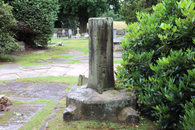
Churchyard cross: Medieval. Ashlar buff sandstone. Base is square below and shaped to octagonal above. This has a chamfered rectangular shaft set into it which has been cut off and shows the setting for a sundial (now missing). East face has the letter B carved on it.
Listing NGR: SJ8417976132


Other nearby listed buildings