Latitude: 51.3443 / 51°20'39"N
Longitude: -1.8161 / 1°48'57"W
OS Eastings: 412905
OS Northings: 160598
OS Grid: SU129605
Mapcode National: GBR 4XX.PN5
Mapcode Global: VHB4K.GGRS
Plus Code: 9C3W85VM+PH
Entry Name: Ladies Bridge
Listing Date: 27 May 1964
Grade: II
Source: Historic England
Source ID: 1366119
English Heritage Legacy ID: 311770
ID on this website: 101366119
Location: Wiltshire, SN9
County: Wiltshire
Civil Parish: Wilcot
Traditional County: Wiltshire
Lieutenancy Area (Ceremonial County): Wiltshire
Tagged with: Bridge
SU 16 SW WILCOT
5/135 Ladies-Bridge 27.5.64 II
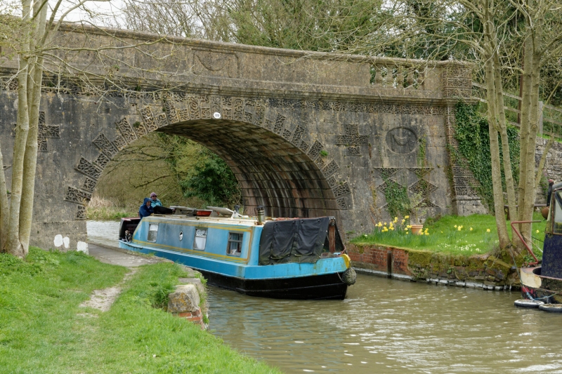
Accommodation bridge over Kennet and Avon Canal. 1808, by John Rennie. Limestone ashlar, with vermiculated stones forming arch and end piers, and various patterned lozenge and triangular vermiculated stones. Recessed panels with towel swags and fan corners. Parapet has balustraded openings at ends and central panel with swag and date. Soffit of bridge has line restication. Large incised graffito of swan. Probably constructed as a feature in Wilcot Manor park.
Listing NGR: SU1290560598
External links are from the relevant listing authority and, where applicable, Wikidata. Wikidata IDs may be related buildings as well as this specific building. If you want to add or update a link, you will need to do so by editing the Wikidata entry.


Other nearby listed buildings