Latitude: 51.3438 / 51°20'37"N
Longitude: -1.6318 / 1°37'54"W
OS Eastings: 425742
OS Northings: 160583
OS Grid: SU257605
Mapcode National: GBR 5ZH.N89
Mapcode Global: VHC23.NHP7
Plus Code: 9C3W89V9+G7
Entry Name: Green Hall
Listing Date: 30 July 1986
Grade: II
Source: Historic England
Source ID: 1365523
English Heritage Legacy ID: 310755
ID on this website: 101365523
Location: East Grafton, Wiltshire, SN8
County: Wiltshire
Civil Parish: Grafton
Built-Up Area: East Grafton
Traditional County: Wiltshire
Lieutenancy Area (Ceremonial County): Wiltshire
Tagged with: House
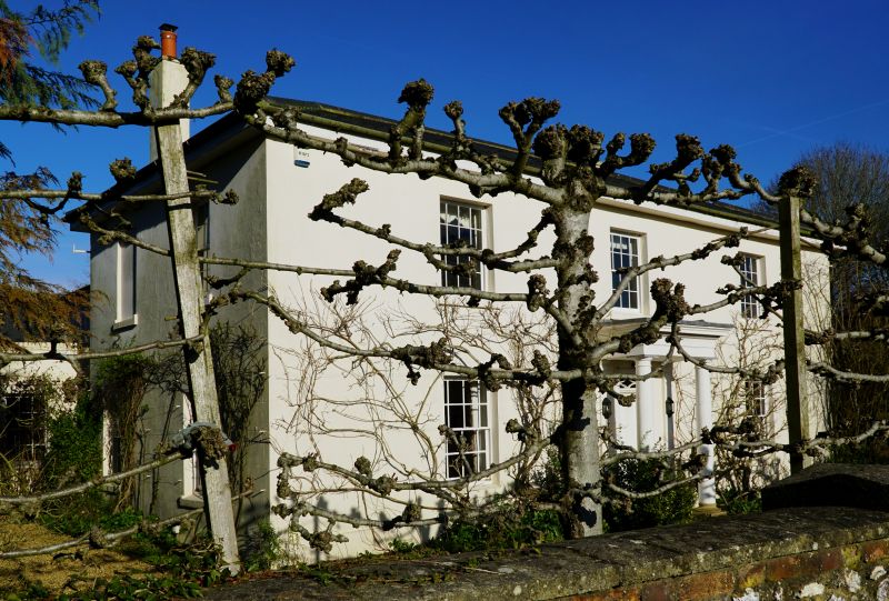
GRAFTON THE GREEN, East Grafton SU 26 SE (north side) 5/35 Green Hall II Detached house, c1830. Stucco on brickwork. Slated roof. Two- storey, 3 bays 2 bays deep and rear wing of 2 bays. Central entrance; 4-panelled door with narrow fanlight within Tuscan portico and entablature. Lower part of columns altered. Sixteen- pane sashes, the ground floor with narrower side panes. Round window to left of door. Roof hipped with wide eaves. French windows to garden on right, and 1 replaced window.
Listing NGR: SU2574260583
External links are from the relevant listing authority and, where applicable, Wikidata. Wikidata IDs may be related buildings as well as this specific building. If you want to add or update a link, you will need to do so by editing the Wikidata entry.


Other nearby listed buildings