Latitude: 51.4799 / 51°28'47"N
Longitude: -1.6209 / 1°37'15"W
OS Eastings: 426425
OS Northings: 175728
OS Grid: SU264757
Mapcode National: GBR 5XY.50X
Mapcode Global: VHC1J.V2GB
Plus Code: 9C3WF9HH+XM
Entry Name: 7, the Green
Listing Date: 22 August 1966
Grade: II
Source: Historic England
Source ID: 1365461
English Heritage Legacy ID: 310493
ID on this website: 101365461
Location: Aldbourne, Wiltshire, SN8
County: Wiltshire
Civil Parish: Aldbourne
Built-Up Area: Aldbourne
Traditional County: Wiltshire
Lieutenancy Area (Ceremonial County): Wiltshire
Tagged with: Building
SU 27 NE ALDBOURNE THE GREEN (west side)
9/33 No 7
22.8.66
GV II
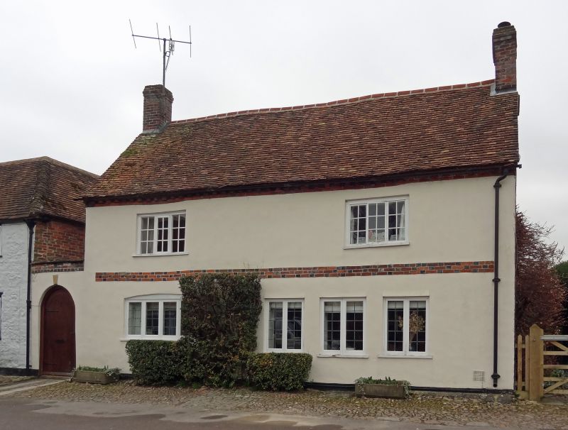
House, C18 - early C19. Brick laced sarsen with rendered brick elevation. Tiled roof. 2-storey, 3 bays, now 2 rooms deep, and long right side rear wing. Entrance in left gable wall. Plat band. Irregular C20 ground floor fenestration, 3-light paned casements to bays 1 and 3 on first floor. Gable stacks. Sarsen cobbled forecourt. Listed for group value only.
Listing NGR: SU2642175724
External links are from the relevant listing authority and, where applicable, Wikidata. Wikidata IDs may be related buildings as well as this specific building. If you want to add or update a link, you will need to do so by editing the Wikidata entry.


Other nearby listed buildings