Latitude: 51.1827 / 51°10'57"N
Longitude: -2.1077 / 2°6'27"W
OS Eastings: 392568
OS Northings: 142612
OS Grid: ST925426
Mapcode National: GBR 2WT.V7S
Mapcode Global: VH97Q.FJ3Q
Plus Code: 9C3V5VMR+3W
Entry Name: Blind House
Listing Date: 11 September 1968
Grade: II
Source: Historic England
Source ID: 1364382
English Heritage Legacy ID: 313272
ID on this website: 101364382
Location: Heytesbury, Wiltshire, BA12
County: Wiltshire
Civil Parish: Heytesbury
Built-Up Area: Heytesbury
Traditional County: Wiltshire
Lieutenancy Area (Ceremonial County): Wiltshire
Church of England Parish: Heytesbury with Tytherington and Knook St Peter and St Paul
Church of England Diocese: Salisbury
HEYTESBURY HIGH STREET ST 92 SW (north side) 9/51 Blind House 11.9.68
GV II
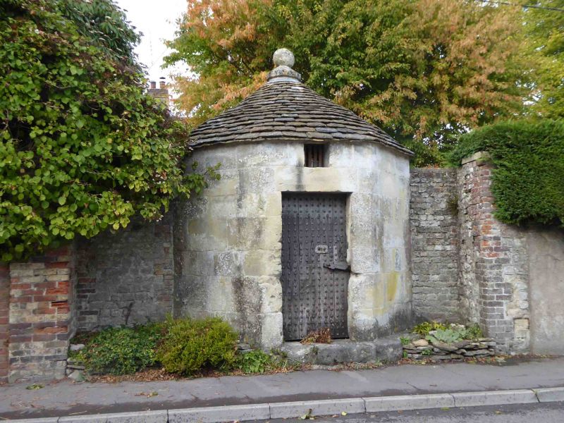
Blind house; village lock-up. Probably C18. Limestone ashlar, stone slate pointed roof. Octagonal. Plain square-head doorcase with planked studded door, over is small square light with iron bars. Roof has ball finial at apex. Interior has simple fitted wooden bench against rear wall, ceiling is ashlar dome. Scheduled Ancient Monument, Wiltshire No 254.
Listing NGR: ST9256842612


Other nearby listed buildings