Latitude: 51.3216 / 51°19'17"N
Longitude: -2.2092 / 2°12'33"W
OS Eastings: 385516
OS Northings: 158070
OS Grid: ST855580
Mapcode National: GBR 1ST.097
Mapcode Global: VH972.N1FQ
Plus Code: 9C3V8QCR+J8
Entry Name: 66, Fore Street
Listing Date: 29 December 1950
Last Amended: 26 November 1976
Grade: II*
Source: Historic England
Source ID: 1364229
English Heritage Legacy ID: 314010
ID on this website: 101364229
Location: Trowbridge, Wiltshire, BA14
County: Wiltshire
Civil Parish: Trowbridge
Built-Up Area: Trowbridge
Traditional County: Wiltshire
Lieutenancy Area (Ceremonial County): Wiltshire
Church of England Parish: Trowbridge St James
Church of England Diocese: Salisbury
Tagged with: Building
FORE STREET 1. 5411 (North West Side) No 66 (formerly listed as No 66 (Premises of ST 8558 5/74 W. Prior)) 29,12.50.
II* GV
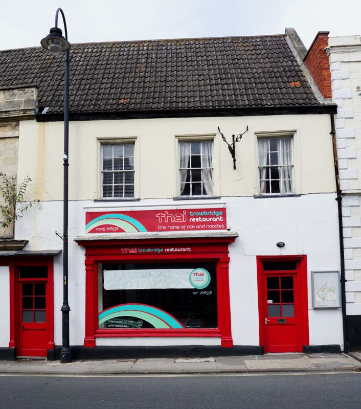
2. C17 or earlier with later front to street. C18 front. 2 storey. Stucco. Small moulded eaves cornice. Modern pantile roof, continuous with adjoining building. 3 windows with moulded frames on 1st floor, glazing bar sashes. Shop window to left hand on ground floor framed with fluted pilasters and entablature with dentilled cornice. Half-glazed door to right hand with plain fanlight in architrave surround (rectangular). Courtyard at rear formed with No 67 - rubble built with C17 cross windows to 1st and 2nd floors.
Nos 65 to 68 (consec), Nos 70 to 73 (consec), railings and gates to Nos 68 and 70, dwarf stone wall to No 72, No 64 (Lloyds Bank) and Usher's Brewery Corner Block, form an outstanding group with No 8 and premises occupied by K.J. Lestor to south west of No 8 Wicker Hill.
Listing NGR: ST8551658070
External links are from the relevant listing authority and, where applicable, Wikidata. Wikidata IDs may be related buildings as well as this specific building. If you want to add or update a link, you will need to do so by editing the Wikidata entry.


Other nearby listed buildings