Latitude: 51.2454 / 51°14'43"N
Longitude: 1.2302 / 1°13'48"E
OS Eastings: 625542
OS Northings: 154539
OS Grid: TR255545
Mapcode National: GBR VZZ.ZSZ
Mapcode Global: VHLGQ.8YQN
Plus Code: 9F3366WJ+53
Entry Name: The Parsonage
Listing Date: 13 October 1952
Last Amended: 3 December 1986
Grade: II
Source: Historic England
Source ID: 1363238
English Heritage Legacy ID: 177971
ID on this website: 101363238
Location: Goodnestone, Dover, Kent, CT3
County: Kent
District: Dover
Civil Parish: Goodnestone
Traditional County: Kent
Lieutenancy Area (Ceremonial County): Kent
Tagged with: Clergy house
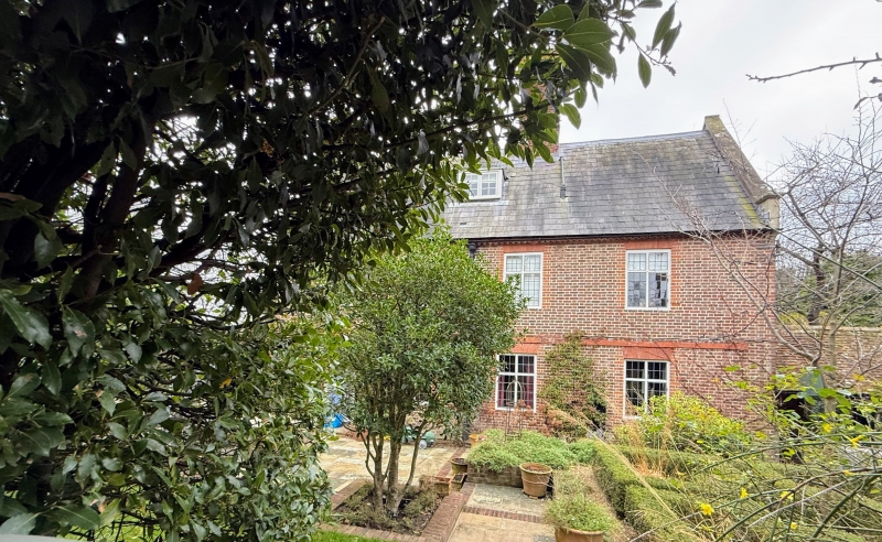
GOODNESTONE THE STREET TR 25 SE (east side) The Parsonage (formerly 3/110 listed as "The Vicarage" 13.10.52 GV II House. Late C17 extended late C19. Red brick, extended with brown brick with blue headers in diaper pattern. Slate roofs. Two parallel ranges. Two storeys and attic with plat band and kneelered parapet gables. One flat roofed and large central stack. Four cross windows on first floor with gauged heads, and 3 on ground floor with boarded door to left with rectangular fanlight. The main entrance front was switched to the left return with the late C19 additions, a second gable rear wing with massive central stack, and half-glazed door with sidelights in recessed porch with moulded arch on imposts.
Listing NGR: TR2554054537
External links are from the relevant listing authority and, where applicable, Wikidata. Wikidata IDs may be related buildings as well as this specific building. If you want to add or update a link, you will need to do so by editing the Wikidata entry.


Other nearby listed buildings