Latitude: 51.2098 / 51°12'35"N
Longitude: 0.7939 / 0°47'37"E
OS Eastings: 595245
OS Northings: 149333
OS Grid: TQ952493
Mapcode National: GBR RW0.3JX
Mapcode Global: VHKK6.QV1F
Plus Code: 9F326Q5V+WH
Entry Name: 11 and 13, High Street
Listing Date: 14 February 1967
Last Amended: 10 October 1980
Grade: II
Source: Historic England
Source ID: 1363017
English Heritage Legacy ID: 180725
ID on this website: 101363017
Location: Charing, Ashford, Kent, TN27
County: Kent
District: Ashford
Civil Parish: Charing
Built-Up Area: Charing
Traditional County: Kent
Lieutenancy Area (Ceremonial County): Kent
Tagged with: Building
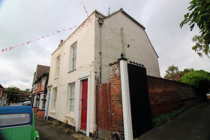
1. CHARING HIGH STREET 5272 (west side) Nos 11 and 13 (formerly listed as Cottage immediately TQ 9549 22/43 14.2.67 south of Peckwater House and Cottage next but one II GV south of Peckwater House) 2. C18. Two storeys and attics painted brick. Tiled roof and parapet with stone coping. Half hipped gable to right-hand side. Two sashes with glazing bars intact. Doorcases with narrow reeded pilasters, projecting cornices over and rectandplar twilights.
Listing NGR: TQ9524349332
External links are from the relevant listing authority and, where applicable, Wikidata. Wikidata IDs may be related buildings as well as this specific building. If you want to add or update a link, you will need to do so by editing the Wikidata entry.


Other nearby listed buildings