Latitude: 51.141 / 51°8'27"N
Longitude: 0.7235 / 0°43'24"E
OS Eastings: 590611
OS Northings: 141493
OS Grid: TQ906414
Mapcode National: GBR QVC.HQ0
Mapcode Global: VHKKK.HLB6
Plus Code: 9F324PRF+99
Entry Name: Wissenden House
Listing Date: 14 February 1967
Grade: II
Source: Historic England
Source ID: 1362989
English Heritage Legacy ID: 180679
ID on this website: 101362989
Location: Wissenden, Ashford, Kent, TN26
County: Kent
District: Ashford
Civil Parish: Bethersden
Traditional County: Kent
Lieutenancy Area (Ceremonial County): Kent
Tagged with: House
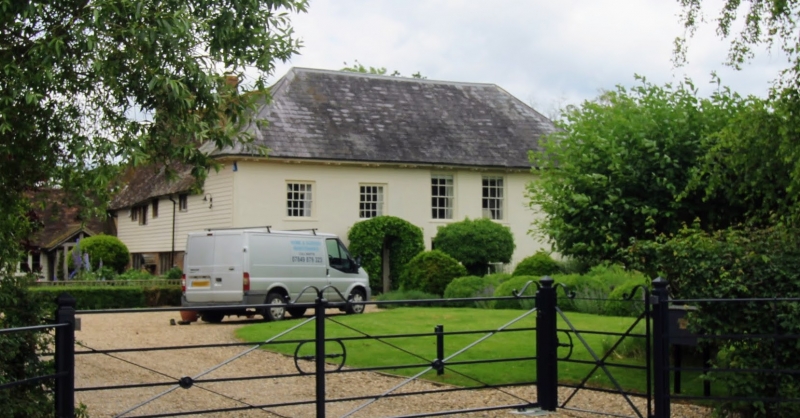
1. 5272 BETHERSDEN WISSENDEN Wissenden House TQ 94 SW 14/41 14.2.67 II 2. L-shaped building. The north-west wing is timber-framed, the date 1567 was found on a ridge tile - refaced with red brick on the ground floor and with weatherboarding above. Tiled roof with pentice at the north end of its west front. Two storeys, 2 casement windows. The south-east wing is C18. Two storeys stuccoed. Hipped slate roof with bracket eaves cornice. Five sash windows with glazing bars intact.
Listing NGR: TQ9061141493
External links are from the relevant listing authority and, where applicable, Wikidata. Wikidata IDs may be related buildings as well as this specific building. If you want to add or update a link, you will need to do so by editing the Wikidata entry.


Other nearby listed buildings