Latitude: 51.1717 / 51°10'18"N
Longitude: 0.9018 / 0°54'6"E
OS Eastings: 602951
OS Northings: 145386
OS Grid: TR029453
Mapcode National: GBR SXW.DTQ
Mapcode Global: VHKKG.LT34
Plus Code: 9F325WC2+MP
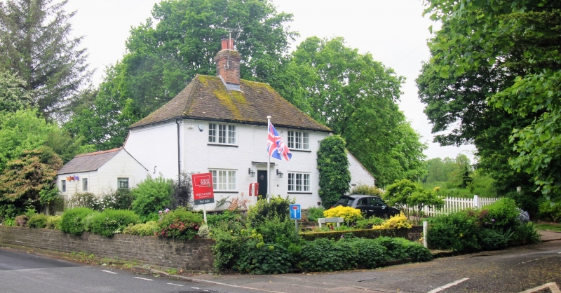
Entry Name: Hall Cottage
Listing Date: 4 June 1976
Grade: II
Source: Historic England
Source ID: 1362818
English Heritage Legacy ID: 179863
ID on this website: 101362818
Location: Kennington, Ashford, Kent, TN25
County: Kent
District: Ashford
Electoral Ward/Division: Kennington
Parish: Kennington
Traditional County: Kent
Lieutenancy Area (Ceremonial County): Kent
Tagged with: Cottage
1. 5344 BALL LANE (South-East Side) Kennington Hall Cottage TR 04 NW 4/96
II
2. C18. 2 storeys painted brick. Hipped tiled roof with brick modillion eaves cornice, the bricks inserted diagonally with the points protruding. 2 3-light casements. Plain doorcase with pilasters and cornice. Later lean-to extension to right hand side.
Listing NGR: TR0295145386
External links are from the relevant listing authority and, where applicable, Wikidata. Wikidata IDs may be related buildings as well as this specific building. If you want to add or update a link, you will need to do so by editing the Wikidata entry.


Other nearby listed buildings