Latitude: 51.1539 / 51°9'14"N
Longitude: 0.6981 / 0°41'53"E
OS Eastings: 588781
OS Northings: 142867
OS Grid: TQ887428
Mapcode National: GBR QV4.P8T
Mapcode Global: VHKKK.18W7
Plus Code: 9F325M3X+H6
Entry Name: Biddenden Green Farmhouse
Listing Date: 14 February 1967
Grade: II*
Source: Historic England
Source ID: 1362699
English Heritage Legacy ID: 181203
ID on this website: 101362699
Location: Biddenden Green, Ashford, Kent, TN27
County: Kent
District: Ashford
Civil Parish: Smarden
Built-Up Area: Smarden
Traditional County: Kent
Lieutenancy Area (Ceremonial County): Kent
Tagged with: Farmhouse
1. 5272 SMARDEN LEWD LANE Biddenden Green Farmhouse TQ 8842 29/35 14.2.67.
II*
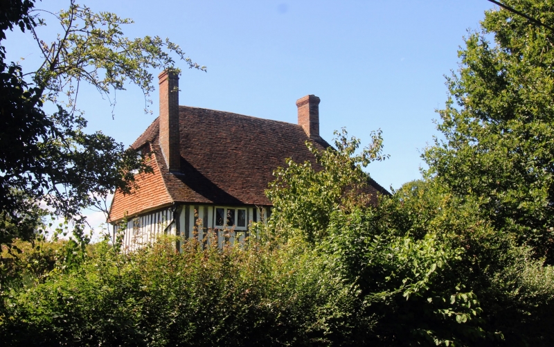
2. C15 timber-framed and close-studded building with plaster infilling. The first floor of the end window bays oversailing on the protruding ends of the floor joints and brackets, the north one with a curved brace. The eaves of the centre portion overhang on bracekets. Steeply-pitched hipped tiled roof with pentice at north end. Casement windows with diamond-shaped leaded panes. Four-centred wooden doorway, set in an C18 moulded architrave surround, with heavy flat hood over on brackets.
Listing NGR: TQ8878142867
External links are from the relevant listing authority and, where applicable, Wikidata. Wikidata IDs may be related buildings as well as this specific building. If you want to add or update a link, you will need to do so by editing the Wikidata entry.


Other nearby listed buildings