Latitude: 51.1167 / 51°7'0"N
Longitude: 0.8639 / 0°51'49"E
OS Eastings: 600536
OS Northings: 139165
OS Grid: TR005391
Mapcode National: GBR RX2.WS1
Mapcode Global: VHKKT.X6K9
Plus Code: 9F324V87+MG
Entry Name: Mulberry House
Listing Date: 14 February 1967
Grade: II
Source: Historic England
Source ID: 1362668
English Heritage Legacy ID: 181010
ID on this website: 101362668
Location: Kingsnorth, Ashford, Kent, TN23
County: Kent
District: Ashford
Civil Parish: Kingsnorth
Built-Up Area: Kingsnorth (Ashford)
Traditional County: Kent
Lieutenancy Area (Ceremonial County): Kent
Tagged with: Building
This list entry was subject to a Minor Amendment on 12 November 2025 to amend the name and address and reformat the text to current standards
TR 03 NW
20/3
KINGSNORTH
CHURCH HILL
Mulberry House
(Formerly listed as Whitegates)
14.2.67
II
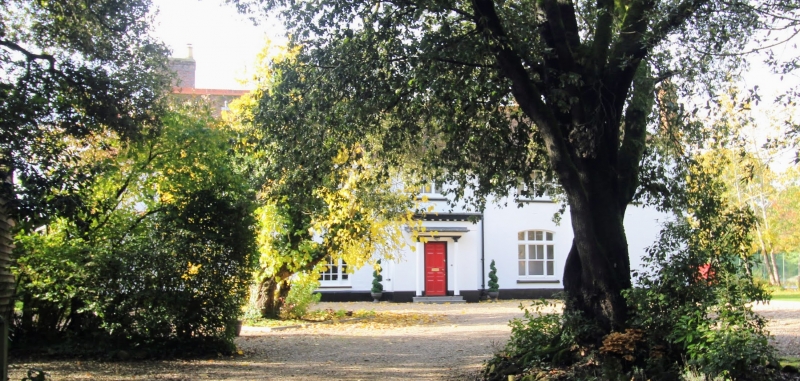
The south-east end is C18. Two storeys and attics painted brick. Hipped tiled roof with three dormers. Wide eaves cornice. Three sashes with glazing bars intact. Porch with slender columns. C19 additions, in red brick, to the north-west and south-west.
Listing NGR: TR0060339175
External links are from the relevant listing authority and, where applicable, Wikidata. Wikidata IDs may be related buildings as well as this specific building. If you want to add or update a link, you will need to do so by editing the Wikidata entry.


Other nearby listed buildings