Latitude: 53.6602 / 53°39'36"N
Longitude: -2.7737 / 2°46'25"W
OS Eastings: 348965
OS Northings: 418472
OS Grid: SD489184
Mapcode National: GBR 9V23.9M
Mapcode Global: WH865.C8DB
Plus Code: 9C5VM66G+3G
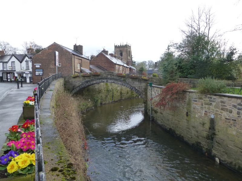
Entry Name: Town Bridge
Listing Date: 17 April 1967
Grade: II
Source: Historic England
Source ID: 1362107
English Heritage Legacy ID: 184332
ID on this website: 101362107
Location: Croston, Chorley, Lancashire, PR26
County: Lancashire
District: Chorley
Civil Parish: Croston
Built-Up Area: Croston
Traditional County: Lancashire
Lieutenancy Area (Ceremonial County): Lancashire
Church of England Parish: Croston St Michael and All Angels
Church of England Diocese: Blackburn
CROSTON THE HILLOCKS SD 41 NE 8/80 Town Bridge 17.4.67 GV II
Bridge, dated 1682 on outside of west parapet. Squared sandstone. Single segmental arch with arch band (reinforced with iron strap), rounded coping to parapets, which are continued in a splay at the south end (carrying iron railings here); humped sett-paved deck. Apex block on west parapet dated 1682 in raised figures on the outer side. Small structure but still a public road bridge; with Church Street immediately to the east and Church of St. Michael which is framed by that street, an essential element of a tightly-knit and both visually and historically interesting group which is the principal architectural asset of the centre of this parish.
Listing NGR: SD4896518472


Other nearby listed buildings