Latitude: 52.6273 / 52°37'38"N
Longitude: -0.5506 / 0°33'2"W
OS Eastings: 498204
OS Northings: 304273
OS Grid: SK982042
Mapcode National: GBR DTQ.CM1
Mapcode Global: WHGM2.J714
Plus Code: 9C4XJCGX+WQ
Entry Name: The Priory
Listing Date: 6 June 1961
Last Amended: 17 December 1984
Grade: II*
Source: Historic England
Source ID: 1361471
English Heritage Legacy ID: 187138
ID on this website: 101361471
Location: Ketton, Rutland, PE9
County: Rutland
Civil Parish: Ketton
Built-Up Area: Ketton
Traditional County: Rutland
Lieutenancy Area (Ceremonial County): Rutland
Church of England Parish: Ketton St Mary the Virgin
Church of England Diocese: Peterborough
Tagged with: Priory
SK 9804-9904 KETTON CHURCH ROAD 15/49 (south side)
6.6.61 The Priory (formerly No 10 (The Priory) including outbuldings to street) GV II*
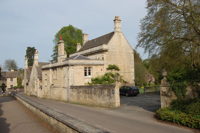
House of various mainly C17 and C18 builds. Of coursed rubble and ashlar, with Collyweston stone slate roofs, coped gables and ashlar ridge and end stacks. Garden front has earliest range to right, dated 1602 over entrance in gable end, 2-storeys and 2 window range, partly masked by conservatory, but with door and 1st floor stone mullioned window of 4 round-headed lights to left. Gable end has 2-light ovolo-moulded stone mullioned window with cornice over. Flanking wing has gable with similar 3-light window dated 1632. To left of original house is C18 range, in 2 parts but both of ashlar, 2 storeys and attics, and treated in a similar manner architecturally. The first, 2 windows wide, continues the line of the original house and the second, to the left, is slightly recessed and raised. This part has five 1st floor windows and 4 ground floor windows, that to the right with Gothic tracery within a quarter-round porch, probably later, linking the 2 parts. All the other windows are sashes within raised architraves with keystones. Band below 1st floor windows. Rear elevation of this block has rusticated quoins and sash windows within moulded architraves with triple keystones, but the street front is dominated by 2 coped gabled wings with end stacks, that to the left of rubble and with a 1618 datestone, and that to the right of ashlar with a datestone W 1663, and two C19 T M window openings, one with mullion and transom. To the right of this a parapeted C19 block, partly recessed, with a similar window, 2 sash windows and a tall 3-shaft chimney stack. Interior of C18 block has panelled room with ceiling of decorative plasterwork.
Listing NGR: SK9820404273
External links are from the relevant listing authority and, where applicable, Wikidata. Wikidata IDs may be related buildings as well as this specific building. If you want to add or update a link, you will need to do so by editing the Wikidata entry.


Other nearby listed buildings