Latitude: 52.7243 / 52°43'27"N
Longitude: -1.0375 / 1°2'14"W
OS Eastings: 465104
OS Northings: 314505
OS Grid: SK651145
Mapcode National: GBR 9MY.2JF
Mapcode Global: WHFK4.1S7C
Plus Code: 9C4WPXF7+P2
Entry Name: Bridge
Listing Date: 1 June 1966
Grade: II
Source: Historic England
Source ID: 1361184
English Heritage Legacy ID: 189541
ID on this website: 101361184
Location: Rearsby, Charnwood, Leicestershire, LE7
County: Leicestershire
District: Charnwood
Civil Parish: Rearsby
Built-Up Area: Rearsby
Traditional County: Leicestershire
Lieutenancy Area (Ceremonial County): Leicestershire
Church of England Parish: Rearsby St Michael and All Angels
Church of England Diocese: Leicester
SK 61 SE
4/75
1.6.66
REARSBY
CHURCH LANE
Bridge
GV
II
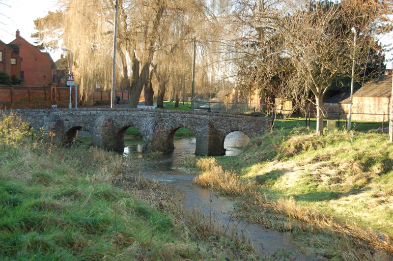
Bridge. Medieval, perhaps C16. Largely granite rubble with brick. Low narrow
structure with 7 arches, 3 over stream and 4 lesser arches for the longer south
approach. 3 rounded cutwaters to east, 2 are granite, but one is brick. Brick
coping to low parapet.
Listing NGR: SK6510414505


Other nearby listed buildings