Latitude: 52.6723 / 52°40'20"N
Longitude: -1.1892 / 1°11'21"W
OS Eastings: 454919
OS Northings: 308599
OS Grid: SK549085
Mapcode National: GBR F23.JX
Mapcode Global: WHDJ9.P3W4
Plus Code: 9C4WMRC6+W8
Entry Name: Wayside with Stable and Wall
Listing Date: 15 March 1984
Grade: II
Source: Historic England
Source ID: 1361078
English Heritage Legacy ID: 189058
ID on this website: 101361078
Location: Anstey, Charnwood, Leicestershire, LE7
County: Leicestershire
District: Charnwood
Civil Parish: Anstey
Built-Up Area: Anstey
Traditional County: Leicestershire
Lieutenancy Area (Ceremonial County): Leicestershire
Church of England Parish: Anstey St Mary
Church of England Diocese: Leicester
Tagged with: Architectural structure
ANSTEY CHURCH LANE (South side) SK 50 NW 5/7 No. 2 (Wayside) with stable and wall
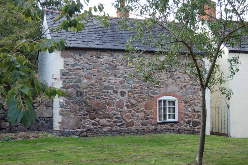
GV II Cottage of c 1800. Painted red brick and slate rubble stone part rendered with Swithland slate roof and 3 brick end stacks. L plan, wing now entrance adjoining street. Original front to left adjoins churchyard. 2 storeys, original front of a 3-light horizontal sliding sash both floors either side of blocked door with similar 2-light over. Cambered lintels and stone sills. Street side has door with renewed C20 window left and same to right with 3-light horizontal sliding sash over. A C19 granite and slate rubble stone and red brick stable adjoins cottage and churchyard. Swithland slate roof. Doors and door with rounded arched lintel and 2 casements over face rear yard. Stone sills. 1 2-light casement to churchyard. Surrounding 2 sides of yard a granite and slate rubble stone wall with stone coping and 2 end piers.
Listing NGR: SK5491908599
External links are from the relevant listing authority and, where applicable, Wikidata. Wikidata IDs may be related buildings as well as this specific building. If you want to add or update a link, you will need to do so by editing the Wikidata entry.


Other nearby listed buildings