Latitude: 52.5544 / 52°33'15"N
Longitude: -1.1379 / 1°8'16"W
OS Eastings: 458546
OS Northings: 295520
OS Grid: SP585955
Mapcode National: GBR 8NF.TBP
Mapcode Global: VHCT1.7294
Plus Code: 9C4WHV36+QR
Entry Name: 7, the Square
Listing Date: 7 October 1957
Grade: II
Source: Historic England
Source ID: 1361069
English Heritage Legacy ID: 188904
ID on this website: 101361069
Location: Countesthorpe, Blaby, Leicestershire, LE8
County: Leicestershire
District: Blaby
Civil Parish: Countesthorpe
Built-Up Area: Countesthorpe
Traditional County: Leicestershire
Lieutenancy Area (Ceremonial County): Leicestershire
Church of England Parish: Countesthorpe St Andrew
Church of England Diocese: Leicester
Tagged with: Building
COUNTESTHORPE SP59 NE THE SQUARE (North Side)
1/34 No. 7
7.10.57.
GV II
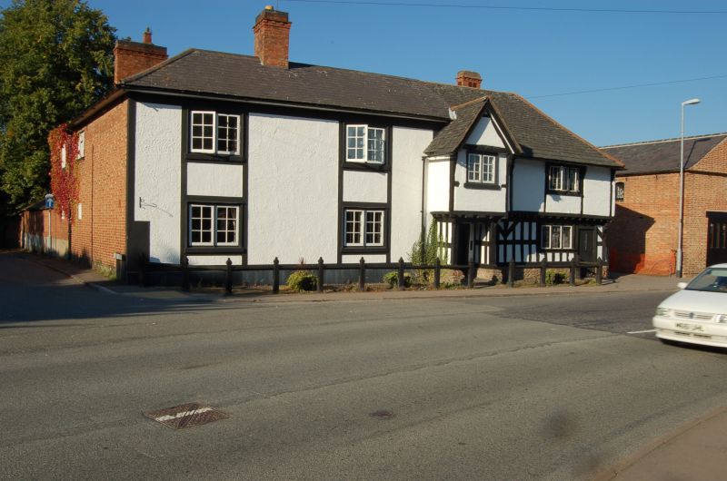
House. Late C16. Timber framed with Swithland and Welsh slate roofs. Two storeyed, 5 bays, with central full height gabled porch with 2 light window above the door. The left hand bays are of brick, with 2 light casement windows on each floor. The right hand section is fully timber framed raised on a rubble plinth, with close studding to ground floor with straight arched bracing to principal posts and jettied upper storey with wider panels. The principal posts here are moulded into consoles. 3 light casement window on each floor and an additional tiny window to ground floor. Axial and rear wall stacks.
Listing NGR: SP5854695520
External links are from the relevant listing authority and, where applicable, Wikidata. Wikidata IDs may be related buildings as well as this specific building. If you want to add or update a link, you will need to do so by editing the Wikidata entry.


Other nearby listed buildings