Latitude: 52.8533 / 52°51'11"N
Longitude: -0.8158 / 0°48'56"W
OS Eastings: 479840
OS Northings: 329081
OS Grid: SK798290
Mapcode National: GBR CPB.4L5
Mapcode Global: WHFJN.FJRY
Plus Code: 9C4XV53M+8M
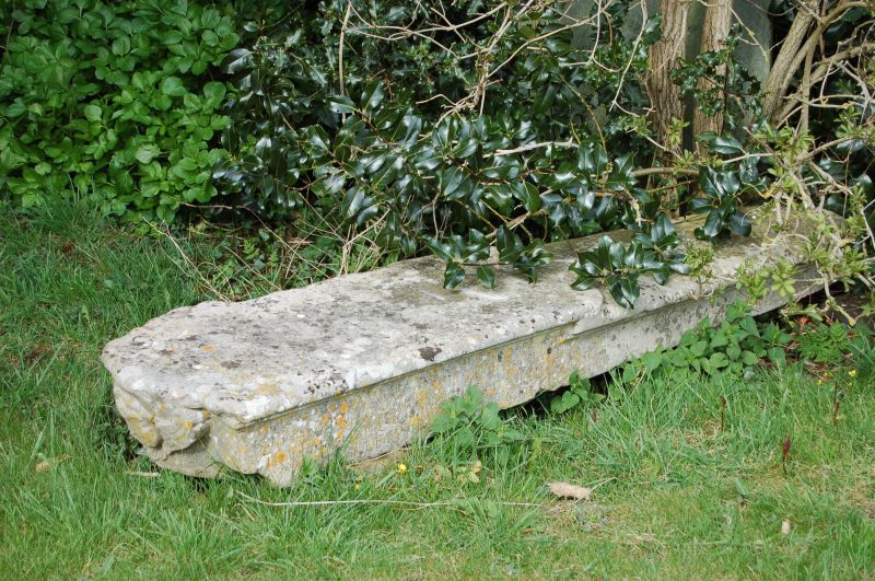
Entry Name: Tomb slab 3 metres east of chancel of Church of St Denys
Listing Date: 22 March 1991
Grade: II
Source: Historic England
Source ID: 1360937
English Heritage Legacy ID: 190169
ID on this website: 101360937
Location: St Denys Church, Eaton, Melton, Leicestershire, NG32
County: Leicestershire
District: Melton
Civil Parish: Eaton
Built-Up Area: Eaton
Traditional County: Leicestershire
Lieutenancy Area (Ceremonial County): Leicestershire
Church of England Parish: Eaton St Denys
Church of England Diocese: Leicester
Tagged with: Tomb
This list entry was subject to a Minor Amendment on 1 October 2024 to amend a typo in the name and address and to reformat the text to current standards.
SK 7928
38/436
EATON
CHURCH LANE (South side)
Tomb slab 3 metres east of chancel of Church of St Denys
GV
II
Tomb slab. C17. Limestone. Tapering slab with rolled top edge and rolled waist. Under head is a carved angel's head. To flanking sides C19 verse.
Listing NGR: SK7984029081
External links are from the relevant listing authority and, where applicable, Wikidata. Wikidata IDs may be related buildings as well as this specific building. If you want to add or update a link, you will need to do so by editing the Wikidata entry.


Other nearby listed buildings