Latitude: 52.751 / 52°45'3"N
Longitude: -0.7242 / 0°43'27"W
OS Eastings: 486210
OS Northings: 317800
OS Grid: SK862178
Mapcode National: GBR CQM.HQP
Mapcode Global: WHFK8.V3BW
Plus Code: 9C4XQ72G+98
Entry Name: New Farmhouse
Listing Date: 7 January 1988
Grade: II
Source: Historic England
Source ID: 1360876
English Heritage Legacy ID: 189919
ID on this website: 101360876
Location: Edmondthorpe, Melton, Leicestershire, LE14
County: Leicestershire
District: Melton
Civil Parish: Wymondham
Traditional County: Leicestershire
Lieutenancy Area (Ceremonial County): Leicestershire
Church of England Parish: Wymondham St Peter
Church of England Diocese: Leicester
Tagged with: Farmhouse
SK 81 NE WYMONDHAM MAIN STREET
Edmondthorpe (west side) 7/162 New Farmhouse
II
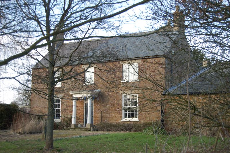
Farmhouse. c.1772 and C19. Coursed and squared ironstone with limestone ashlar dressings and slate roof. 2 gable and single ridge brick stacks. 2 storeys, 3 bays. L-plan. South front has a central Doric columned porch with moulded entablature and late C19 4 panel door in plain jambs with overlight, flanked by single glazing bar sashes. Above, a central 2 light glazing bar casement, flanked by single 3 light glazing bar casements. All the windows have keystoned ashlar lintels. East side has an off- centre door with C19 gabled hood, flanked on either side by a casement. Beyond, to left, a C19 casement with segmental head and to right, a door. Beyond, to right, a datestone inscribed 'MWP 1772'. Above, to left, 2 casements. Adjoining mid C19 farm buildings are not included in this listing.
Listing NGR: SK8621017800
External links are from the relevant listing authority and, where applicable, Wikidata. Wikidata IDs may be related buildings as well as this specific building. If you want to add or update a link, you will need to do so by editing the Wikidata entry.


Other nearby listed buildings