Latitude: 51.4871 / 51°29'13"N
Longitude: -0.1076 / 0°6'27"W
OS Eastings: 531489
OS Northings: 178163
OS Grid: TQ314781
Mapcode National: GBR NP.02
Mapcode Global: VHGR0.2WZB
Plus Code: 9C3XFVPR+VX
Entry Name: 126-132, Kennington Park Road SE11
Listing Date: 15 May 1968
Grade: II
Source: Historic England
Source ID: 1358302
English Heritage Legacy ID: 204337
ID on this website: 101358302
Location: Newington, Lambeth, London, SE11
County: London
District: Lambeth
Electoral Ward/Division: Newington
Parish: Non Civil Parish
Built-Up Area: Lambeth
Traditional County: Surrey
Lieutenancy Area (Ceremonial County): Greater London
Church of England Parish: North Lambeth
Church of England Diocese: Southwark
Tagged with: Building
KENNINGTON PARK ROAD SE11 1. (west side) 5023 Nos 126 to 132 (even) TQ 3178 5/515 15.5.68
II GV
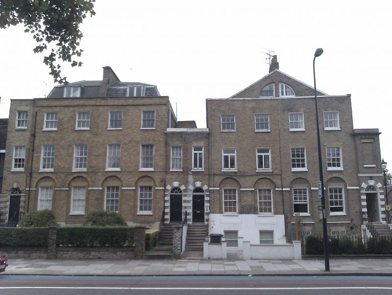
2. Two early C19 pairs, each 3 storeys, attic and basement, 2 windows, with 2-storey and basement linking entrance bay. Nos 126 end 128 have gable end with split lunette, others have slated mansard with dormers. Stock brick, stone-coped parapet. Cornice and blocking course in links. No 132 has link raised to full height in unmatched brick. Arcaded ground floor with impost band. Incised stucco basement and outer arcade piers to nos 130 and 132. Gauged flat brick arches to sash window with glazing bars (No 128 modern casements). Eight steps with cast iron handrails to 6-panel doors with reeded head and fanlight (No 126 radial) in alternating block surrounds with vermiculate rustication and triple keystone. Included for group value in spite of alterations.
Listing NGR: TQ3148978163
External links are from the relevant listing authority and, where applicable, Wikidata. Wikidata IDs may be related buildings as well as this specific building. If you want to add or update a link, you will need to do so by editing the Wikidata entry.


Other nearby listed buildings