Latitude: 51.3709 / 51°22'15"N
Longitude: -0.138 / 0°8'16"W
OS Eastings: 529704
OS Northings: 165188
OS Grid: TQ297651
Mapcode National: GBR F7.KVF
Mapcode Global: VHGRK.KSDX
Plus Code: 9C3X9VC6+9Q
Entry Name: Boundary Walls to Beddington Place Along East Side of Churchyard and Along Church Lane
Listing Date: 1 March 1974
Grade: II
Source: Historic England
Source ID: 1357592
English Heritage Legacy ID: 206704
ID on this website: 101357592
Location: Beddington, Sutton, London, SM6
County: London
District: Sutton
Electoral Ward/Division: Beddington North
Parish: Non Civil Parish
Built-Up Area: Sutton
Traditional County: Surrey
Lieutenancy Area (Ceremonial County): Greater London
Church of England Parish: Beddington
Church of England Diocese: Southwark
Tagged with: Wall
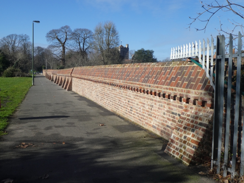
1. CHURCH ROAD 4430 (East Side) BEDDINGTON Boundary Walls to Beddington Place along east side of Churchyard and along Church Lane TQ 2965 SE 13/42 II GV 2. The emparking of Carew Manor lands took place in C16 and again in early C17, the latter in the time of Sir Francis Carew. It is possible that at least the wall along Church Lane dates from one of these periods. Wall along Church Lane extends east for several hundred yards from the corner with the boundary wall to the east of the Churchyard. Wall of red brick with battered coping, roll moulding, dentil course and plinth; very high and rounded at western corner but descends in height towards east. Gateway with Gothic arch, plain parapet and buttresses. To east of gateway, wall is supported by buttresses [14]; coping has been broken down in places and the brickwork is in need of repair. Boundary wall with east side of churchyard probably also at least of C17 date; north and south parts of its length of brick with battered coping; towards middle a much lower build with tile course and plain capping, apparently of later date. 3 brick pilasters with stone capping.
Parish Church of St Mary the Virgin, Lychgates, Churchyard Walls and wall along Church Lane, Orangery Wall, Beddington Place, gate and screen, Pigeon House, Nos l to 3 (consec) Beddington Park Cottages, premises occuppied by Hockey Club and adjoining structure, East Lodge, wall south-west of Beddinqton Park Cottages and garden walls to north of Orangery and Beddington Place form a group.
Listing NGR: TQ2970465188
External links are from the relevant listing authority and, where applicable, Wikidata. Wikidata IDs may be related buildings as well as this specific building. If you want to add or update a link, you will need to do so by editing the Wikidata entry.


Other nearby listed buildings