Latitude: 51.5012 / 51°30'4"N
Longitude: -0.1256 / 0°7'32"W
OS Eastings: 530198
OS Northings: 179695
OS Grid: TQ301796
Mapcode National: GBR HJ.Y1
Mapcode Global: VHGQZ.RJYJ
Plus Code: 9C3XGV2F+FQ
Entry Name: St Stephen's Tavern
Listing Date: 13 May 1983
Grade: II
Source: Historic England
Source ID: 1357232
English Heritage Legacy ID: 208797
Also known as: St Stephens Tavern, Westminster
St Stephens Tavern
ID on this website: 101357232
Location: Westminster, London, SW1A
County: London
District: City of Westminster
Electoral Ward/Division: St James's
Parish: Non Civil Parish
Built-Up Area: City of Westminster
Traditional County: Middlesex
Lieutenancy Area (Ceremonial County): Greater London
Church of England Parish: St Martin-in-the-Fields
Church of England Diocese: London
Tagged with: Pub
TQ 3079 NW CITY OF WESTMINSTER BRIDGE STREET, SW1 92/38 13.5.83 No 10 (St Stephen's Tavern)
G.V. II
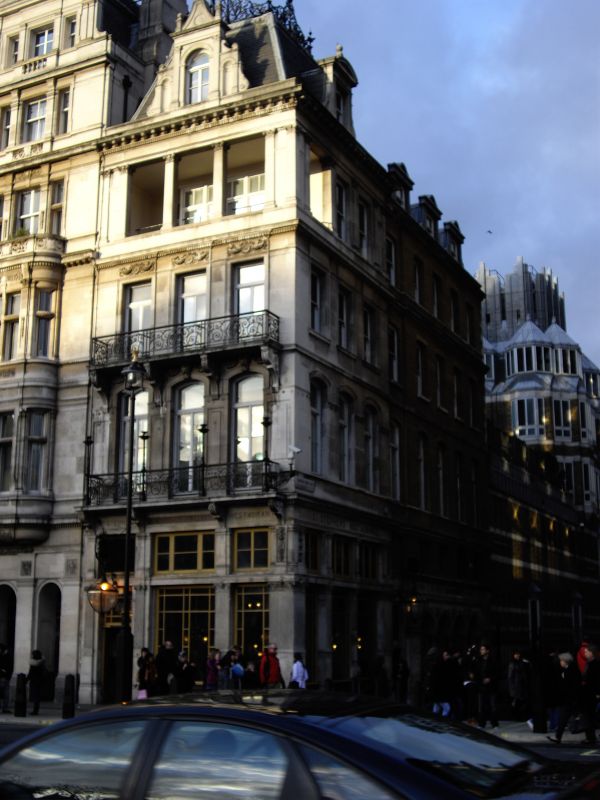
Public house and dining rooms. Dated 1875. Portland stone and brick, slate roof. Eclectic French Renaissance style with pavilion roof. 4 storeys and attic. Narrow 3-window front with 8-window long return to Cannon Row. Ground floor has public house front with basket-handle arched window and entrance set back under corner. Close set architraved 1st and 2nd floor windows and feature of open columned loggia to 3rd floor. Cornices to each floor, the crowning one surmounted by elaborate stone dormer. Ornamented cast iron balconies to 1st and 2nd floors; cast iron cresting to front pavilion. Similar 3-window return, the further 5 bays in brick and stone with elaborate piers articulating ground floor; stone dormers.
Listing NGR: TQ3019879695
External links are from the relevant listing authority and, where applicable, Wikidata. Wikidata IDs may be related buildings as well as this specific building. If you want to add or update a link, you will need to do so by editing the Wikidata entry.


Other nearby listed buildings