Latitude: 53.4852 / 53°29'6"N
Longitude: -2.5673 / 2°34'2"W
OS Eastings: 362453
OS Northings: 398873
OS Grid: SJ624988
Mapcode National: GBR BXH4.ZC
Mapcode Global: WH985.JNPJ
Plus Code: 9C5VFCPM+33
Entry Name: Byrom Hall
Listing Date: 15 November 1966
Grade: II
Source: Historic England
Source ID: 1356257
English Heritage Legacy ID: 213485
ID on this website: 101356257
Location: Lowton, Wigan, Greater Manchester, WA3
County: Wigan
Electoral Ward/Division: Golborne and Lowton West
Parish: Non Civil Parish
Traditional County: Lancashire
Lieutenancy Area (Ceremonial County): Greater Manchester
Church of England Parish: Lowton St Luke
Church of England Diocese: Liverpool
Tagged with: House
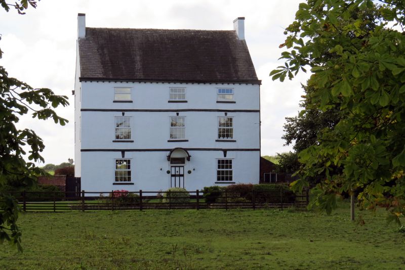
GOLBORNE SLAG LANE SJ 69 NW (north-west side) 5/17 Byrom Hall 15/11/66 II House. 1713 formerly to be seen on a lead rainwater head. Rendered English garden wall bond brick with slate roof. Double-depth central-staircase plan with 3 x 2 bays and 3 storeys. Central panelled door with overlight has barrel- shaped canopy on enriched brackets. The windows which have all been replaced by C20 casements have stone sills and keystones. Continuous first and second floor bands and a modillioned eaves cornice. Gable chimney stacks to a steeply pitched roof. Similar windows to sides and rear. Small oval openings in left gable. Interior: dogleg stair with heavy rail, rectangular newels with sunk panels and barleysugar balusters on a closed string with pulvinated frieze. All the doors have 2 fielded panels with bolection mouldings one of which is still marked " cheese room". Some crosswalls are said to be timber-framed. The lead downpipe which no longer exists had 3 hedgehogs on the fixing lugs.
Listing NGR: SJ6245398873
External links are from the relevant listing authority and, where applicable, Wikidata. Wikidata IDs may be related buildings as well as this specific building. If you want to add or update a link, you will need to do so by editing the Wikidata entry.


Other nearby listed buildings