Latitude: 51.6091 / 51°36'32"N
Longitude: -1.8747 / 1°52'28"W
OS Eastings: 408776
OS Northings: 190033
OS Grid: SU087900
Mapcode National: GBR 3SF.0VQ
Mapcode Global: VHB35.GT9C
Plus Code: 9C3WJ45G+J4
Entry Name: Pond Farmhouse
Listing Date: 17 January 1985
Grade: II*
Source: Historic England
Source ID: 1356025
English Heritage Legacy ID: 317976
ID on this website: 101356025
Location: Purton Stoke, Wiltshire, SN5
County: Wiltshire
Civil Parish: Purton
Traditional County: Wiltshire
Lieutenancy Area (Ceremonial County): Wiltshire
Church of England Parish: Purton
Church of England Diocese: Bristol
Tagged with: Farmhouse
SU 08 SE PURTON POND LANE, PURTON STOKE 8/330 Pond Farmhouse 17.1.85 II*
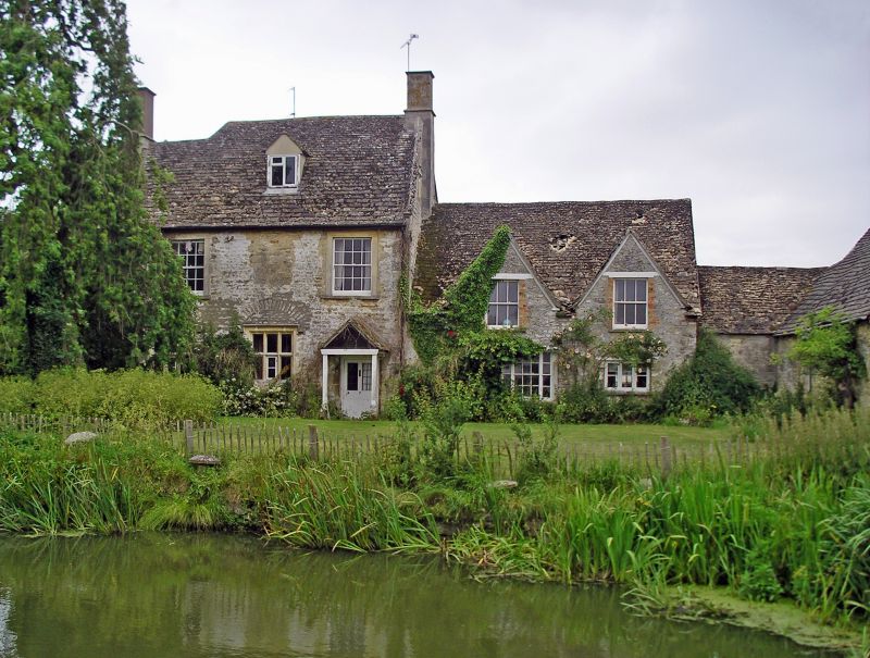
Farmhouse. Late C16, C17 and C18, on earlier moated site. Limestone rubble. Stone slate roof. 2-storeys and attic. Original building to rear, 2 bays 1 storey and attic, to which is added early C17 'L' plan front block of 3 bays, limestone rubble with ashlar dressings and offset plinth. This has central stair hall but plan altered later. To rear further extensions in C19 and C20. Original building has later sash windows and 2 gables with 6- pane sashes. C17 building has hollow chamfered stone-mullioned windows, some transomed, with elliptical relieving arches over. On upper floor, these replaced with 16-pane sashes in raised stone surrounds, some blocked by insertion of stack. Half glazed door in trellised pitched porch. Left and rear gable raised and coped. Inserted stack has shaped shoulders and rebuilt shaft. 1 dormer. C18 stone wine cellar to rear. Interior of early building has heavy chamfered cross beams and joists, and formerly timber framed partitions with wattle and daub, now surviving on first floor only. Later building has ovolo moulded ceiling beams and some early doors. Reset datestone of 1698. Stair replaced C20. The house was the country retreat of the Astronomer Royal, Nevil Maskelyne, and home of the Bathe family in the C18. Good detached stone cattle house of 1914 on north side.
Listing NGR: SU0877690033
External links are from the relevant listing authority and, where applicable, Wikidata. Wikidata IDs may be related buildings as well as this specific building. If you want to add or update a link, you will need to do so by editing the Wikidata entry.


Other nearby listed buildings