Latitude: 51.0661 / 51°3'57"N
Longitude: -1.7983 / 1°47'53"W
OS Eastings: 414227
OS Northings: 129656
OS Grid: SU142296
Mapcode National: GBR 51F.24X
Mapcode Global: FRA 7639.K7B
Plus Code: 9C3W3682+CM
Entry Name: 34, the Close
Listing Date: 28 February 1952
Grade: II*
Source: Historic England
Source ID: 1355844
English Heritage Legacy ID: 319013
ID on this website: 101355844
Location: The Friary, Wiltshire, SP1
County: Wiltshire
Civil Parish: Salisbury
Built-Up Area: Salisbury
Traditional County: Wiltshire
Lieutenancy Area (Ceremonial County): Wiltshire
Tagged with: Building
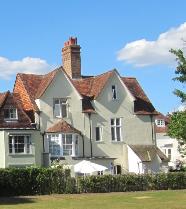
THE CLOSE 1. 1594 No 34 SU 1429 NW 3/31 28.2.52. II* GV
2. C17/C18 and probably earlier origin. Altered C19. 2 storeys and attic, stucco faced. Steep gable end old tile roof. The north front has a gable, the upper part has recent tile hanging. Irregular fenestration including altered late C18 canted bay window with moulded cornice on 1st floor. Remaining windows C19 casements, some early others later with stone mullions, drip moulds. There was formerly an C18 door below canted bay. The east front has 2 gables with bargeboards, C19. 2 storey C19 canted bay to left with pent roof, mullioned transomed casement lights pointed panels to apron. 2 light casement to right on 1st floor and pointed stone archway with drip mould below, the door set back. The south front is double gabled with early C19 casements to right and later 1 storey extension. To left in attic a 2 light stone mullioned C17 casement. Late C18 canted bay window with pent roof on 1st floor, sashes glazing bars intact. Glazed door and early C19 casement below on ground floor. Picturesque.
All the listed buildings in the Close form an outstanding group.
Listing NGR: SU1422629656
External links are from the relevant listing authority and, where applicable, Wikidata. Wikidata IDs may be related buildings as well as this specific building. If you want to add or update a link, you will need to do so by editing the Wikidata entry.


Other nearby listed buildings