Latitude: 51.0661 / 51°3'58"N
Longitude: -1.797 / 1°47'49"W
OS Eastings: 414322
OS Northings: 129663
OS Grid: SU143296
Mapcode National: GBR 51F.2HV
Mapcode Global: FRA 7639.KQP
Plus Code: 9C3W3683+F6
Entry Name: 26, the Close
Listing Date: 28 February 1952
Grade: II*
Source: Historic England
Source ID: 1355841
English Heritage Legacy ID: 319002
ID on this website: 101355841
Location: The Friary, Wiltshire, SP1
County: Wiltshire
Civil Parish: Salisbury
Built-Up Area: Salisbury
Traditional County: Wiltshire
Lieutenancy Area (Ceremonial County): Wiltshire
Tagged with: Building
THE CLOSE 1. 1594 No 26 SU 1429 NW 3/35 28.2.52. II* GV
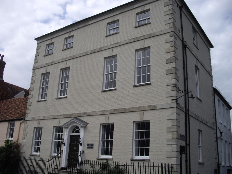
2. Late C18. 3 storey and basement. Colourwashed brick (all headers) stone bands at each floor level, and over 2nd floor windows chamfered stone quoins. Small moulded eaves cornice and hipped old tile roof. 4 small squash windows on 2nd floor. 4 tall windows with venetian shutters on 1st floor. 4 windows, no glazing bars on ground floor and 4 in basement. All windows with rubbed brick arches and keystones. Central 6-panel door approached by 7 moulded stone steps. Doorcase of pilasters with moulded and rosetted caps and ornamented with string of bell shaped flowers descending from caps, with ribbon bow at top. Arched opening with cross fluted surrounds, enclosing arched fanlight with reversed curved glazing pattern. Pilasters have moulded and dentilled broken entablature and similar open pediment over. The east front repeats design with one casement on each floor except for 2 in basement.
All the listed buildings in the Close form an outstanding group.
Listing NGR: SU1432129662
External links are from the relevant listing authority and, where applicable, Wikidata. Wikidata IDs may be related buildings as well as this specific building. If you want to add or update a link, you will need to do so by editing the Wikidata entry.


Other nearby listed buildings