Latitude: 55.0174 / 55°1'2"N
Longitude: -1.4253 / 1°25'31"W
OS Eastings: 436845
OS Northings: 569354
OS Grid: NZ368693
Mapcode National: GBR LBHF.76
Mapcode Global: WHD4S.24KY
Plus Code: 9C7W2H8F+XV
Entry Name: Land of Green Ginger Shopping Mall and Former Church Hall Adjoining on East
Listing Date: 16 November 1978
Grade: II
Source: Historic England
Source ID: 1354984
English Heritage Legacy ID: 303313
ID on this website: 101354984
Location: Tynemouth, North Tyneside, Tyne and Wear, NE30
County: North Tyneside
Electoral Ward/Division: Tynemouth
Parish: Non Civil Parish
Built-Up Area: Tynemouth
Traditional County: Northumberland
Lieutenancy Area (Ceremonial County): Tyne and Wear
Church of England Parish: Tynemouth Priory Holy Saviour
Church of England Diocese: Newcastle
Tagged with: Architectural structure
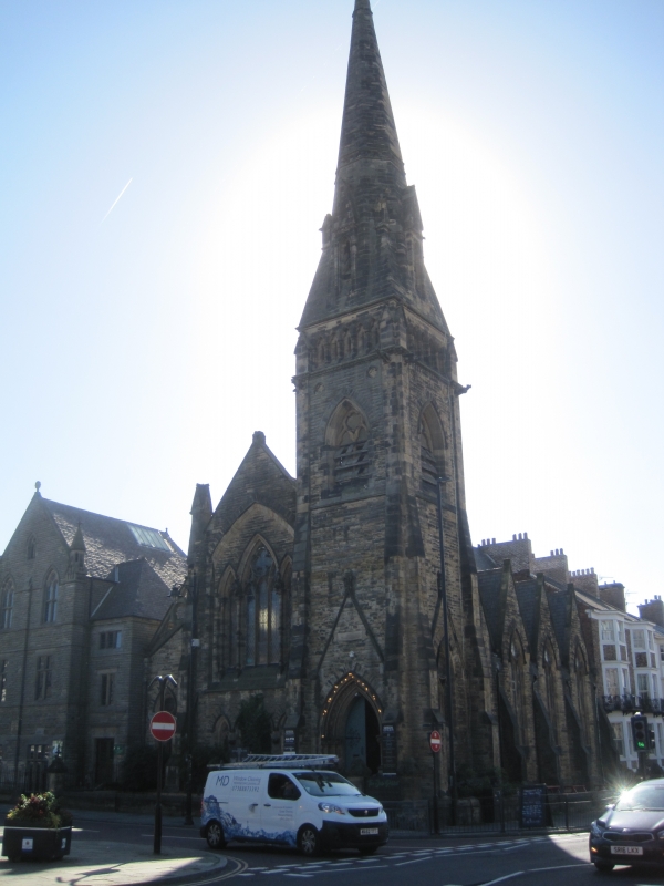
TYNEMOUTH FRONT STREET (south side) NZ 3669 SE Tynemouth 9/67 Land of Green Ginger Shopping Mall and former church hall 16.11.78 adjoining on east. G.V. II Congregational church (now shopping mall) and hall. Church 1868 by Thomas Oliver; hall dated 1886 in door lintel. Coursed rock-faced stone with ashlar dressings; Welsh slate roof with stone gable coping. Stone spire and spirelets. Modified late C13 style. Church oriented north-south; ritual west to Front Street has tower at right, hall adjoining on east. Steps up to tower double door which has ballflower ornament to moulded arch on twin shafts; upper stages of tower have 2-light belfry openings beneath arcades with slit windows. Broach spire with lucarnes. 4-light west window. Lower one-bay link to 3-storey 3-bay gabled hall on left, of similar materials. Stone mullioned-and-transomed windows, the upper ones pointed-arched. Right return of church has 4 gables with 2-light windows. Historical note: hall erected by members and friends of the Congregational church for public and educational purposes. Source: H.E. Craster History of Northumberland vol. VIII 1907. p.377.
Listing NGR: NZ3684569354
External links are from the relevant listing authority and, where applicable, Wikidata. Wikidata IDs may be related buildings as well as this specific building. If you want to add or update a link, you will need to do so by editing the Wikidata entry.


Other nearby listed buildings