Latitude: 50.9543 / 50°57'15"N
Longitude: -1.2132 / 1°12'47"W
OS Eastings: 455361
OS Northings: 117502
OS Grid: SU553175
Mapcode National: GBR 98W.03T
Mapcode Global: FRA 86BL.C61
Plus Code: 9C2WXQ3P+PP
Entry Name: Shield House and Boundary Wall
Listing Date: 1 September 1987
Grade: II
Source: Historic England
Source ID: 1350549
English Heritage Legacy ID: 146061
ID on this website: 101350549
Location: Bishop's Waltham, Winchester, Hampshire, SO32
County: Hampshire
District: Winchester
Civil Parish: Bishops Waltham
Built-Up Area: Bishop's Waltham
Traditional County: Hampshire
Lieutenancy Area (Ceremonial County): Hampshire
Church of England Parish: Bishop's Waltham St Peter
Church of England Diocese: Portsmouth
Tagged with: Building
BISHOPS WALTHAM BROOK STREET SU 55 17 9/51 Shield House and Boundary Wall. II
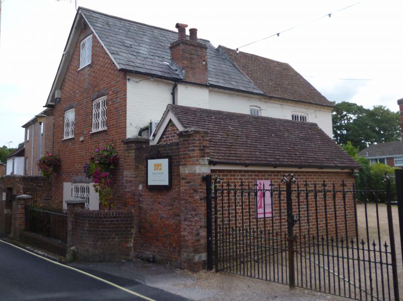
House. Late C18 house with forward addition of the mid C19. Walls of brick work in Flemish bond with blue headers, cambered blue brick arches, brick dentil eaves. Slate roof to the front part, tile to the rear. Gabled east front of three storeys, 1 above 2 above 1 windows. Cast-iron 'Tudor' casements. Plain doorway at the south side. To the north side a wall connects two piers, in front of the inner pier a low wall extends forward on a curve to meet a lower pier: to the south side is a high boundary wall, with a gateway entrance, which drops by a curve to a lower pier: the space between the two lower piers is filled by a plain wrought-iron rail, standing on a low brick wall.
Listing NGR: SU5538817534
External links are from the relevant listing authority and, where applicable, Wikidata. Wikidata IDs may be related buildings as well as this specific building. If you want to add or update a link, you will need to do so by editing the Wikidata entry.


Other nearby listed buildings