Latitude: 52.2056 / 52°12'20"N
Longitude: -2.1031 / 2°6'11"W
OS Eastings: 393048
OS Northings: 256376
OS Grid: SO930563
Mapcode National: GBR 2HF.P2T
Mapcode Global: VH92P.HTJL
Plus Code: 9C4V6V4W+6P
Entry Name: Commandery Farmhouse
Listing Date: 4 September 1986
Grade: II
Source: Historic England
Source ID: 1350107
English Heritage Legacy ID: 147699
ID on this website: 101350107
Location: Crowle, Wychavon, Worcestershire, WR7
County: Worcestershire
District: Wychavon
Civil Parish: Crowle
Traditional County: Worcestershire
Lieutenancy Area (Ceremonial County): Worcestershire
Church of England Parish: Crowle with Bredicot
Church of England Diocese: Worcester
Tagged with: Farmhouse
CROWLE CP LOWER CROWLE SO 95 NW 6/23 Commandery Farmhouse
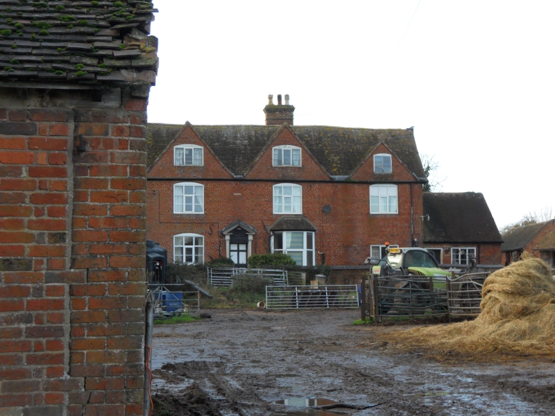
GV II Farmhouse. c1600, remodelled mid-C19. Part timber-framed with rendered infill and brick refacing, part brick, plain tiled roofs. Assymetrical plan with main range aligned north/south, rear parallel range at north end and central south end rear wings; two storeys and attic with larger gabled dormers. East front elevation: three bays with large gable above each; windows are C19 3-light casements with cambered heads, except for central bay of ground floor which has a canted, hipped-roofed, bay window with 4-pane sash window and side plain sashes, and also ground-floor window of right bay which is an inserted C20 3-light casement with flat head; main entrance between left and central bay has an open pediment, panelled pilasters and 6-panelled door. To left of C20 window is a blocked doorway with a cambered head. Left end ridge stack and large chimney to rear centre of ridge. Timber-framing exposed in north gable end, six panels from sill to tie-beam and collar and tie-beam truss with three collars and struts; framing is partly concealed by C19 single-storey kitchen wing which has a dentilled eaves cornice, a 3-light casement and ledged and battened door in its east front elevation and a large chimney at its north gable end. Interior: no framing exposed apart from north gable end; roof not accessible. The farmhouse must have been one of the largest and most important timber- framed buildings in the parish during the C17 as implied by the proportions of the exposed frame in the north gable end. It is very probable that con- siderable further evidence of this is concealed within the building.
Listing NGR: SO9304856376
External links are from the relevant listing authority and, where applicable, Wikidata. Wikidata IDs may be related buildings as well as this specific building. If you want to add or update a link, you will need to do so by editing the Wikidata entry.


Other nearby listed buildings