Latitude: 52.2999 / 52°17'59"N
Longitude: -2.7474 / 2°44'50"W
OS Eastings: 349130
OS Northings: 267123
OS Grid: SO491671
Mapcode National: GBR BJ.XB8Z
Mapcode Global: VH84H.BGF8
Plus Code: 9C4V77X3+W2
Entry Name: The Boot Inn
Listing Date: 30 September 1986
Grade: II
Source: Historic England
Source ID: 1349871
English Heritage Legacy ID: 150119
ID on this website: 101349871
Location: Orleton, County of Herefordshire, SY8
County: County of Herefordshire
Civil Parish: Orleton
Built-Up Area: Orleton
Traditional County: Herefordshire
Lieutenancy Area (Ceremonial County): Herefordshire
Church of England Parish: Orleton
Church of England Diocese: Hereford
Tagged with: Inn
ORLETON CP KINGS ROAD (north side) SO 4967 10/97 The Boot Inn 30.9.86 GV II
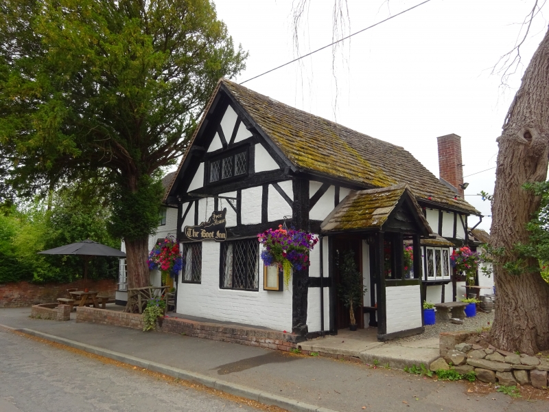
House, now public house. Cl7, extended early C19, restored mid-C20. Timber- frame with painted brick infill, extended in painted brick, with tile roof. T-plan, cross-wing of two framed bays aligned north/south, other range extend- ing to west. Lateral stack to rear of C19 range. South (street) front: two storeys, two windows, a 4-light casement to left, a 3-light casement to right, two canted bay windows below. The entrance centrally placed with gabled tiled canopy and C20 panelled door. Cross-wing to right of one storey with attic lit by a 3-light C20 casement in gable, over two casements, that to left of two lights, to right of three lights. Framing: three square panels high with straight angle braces, gable-end truss has two struts to collar with V-struts in apex. Interior has some chamfered and stopped beams. (RCHM, 3, p 157, no 5).
Listing NGR: SO4913067123
External links are from the relevant listing authority and, where applicable, Wikidata. Wikidata IDs may be related buildings as well as this specific building. If you want to add or update a link, you will need to do so by editing the Wikidata entry.


Other nearby listed buildings