Latitude: 52.1405 / 52°8'25"N
Longitude: -3.0092 / 3°0'33"W
OS Eastings: 331030
OS Northings: 249619
OS Grid: SO310496
Mapcode National: GBR F6.7661
Mapcode Global: VH77N.SGJD
Plus Code: 9C4R4XRR+68
Entry Name: Cartref
Listing Date: 31 October 1988
Grade: II
Source: Historic England
Source ID: 1349571
English Heritage Legacy ID: 150643
ID on this website: 101349571
Location: Eardisley, County of Herefordshire, HR3
County: County of Herefordshire
Civil Parish: Eardisley
Built-Up Area: Eardisley
Traditional County: Herefordshire
Lieutenancy Area (Ceremonial County): Herefordshire
Church of England Parish: Eardisley with Bollingham and Willersley
Church of England Diocese: Hereford
Tagged with: Building
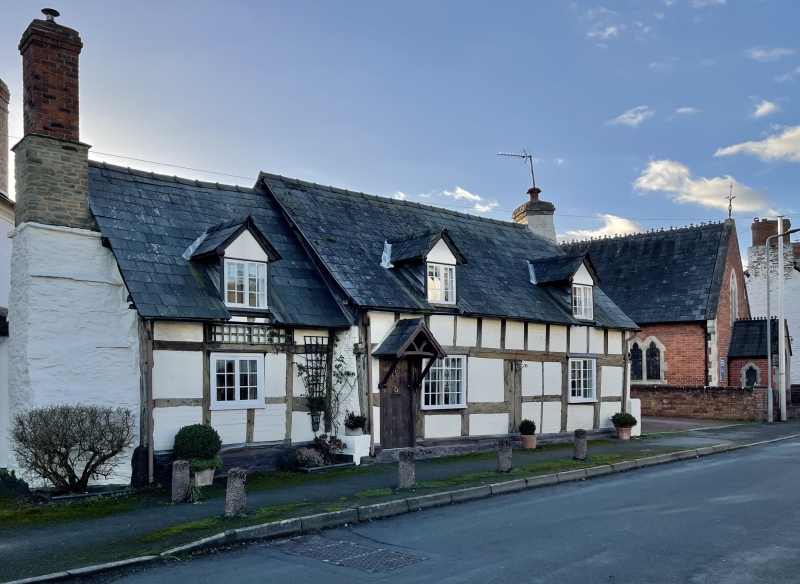
EARDISLEY CP WHITNEY ROAD (south side) SO 3049 - 3149 7/88 Cartref GV II House. Circa 1600, altered C18 and mid-C20. Timber-framed with painted brick and rendered infill on rubble base with some painted rubble walling and slate roofs. One plus two framed bays aligned east/west; east end has an external painted rubble chimney with tiled offsets, a brick stack and a probable bread oven. There is also a smaller external painted rubble chimney at the west end which has a diagonal rubble stack with brick capping. Single storey and attic with dormers. Framing: two rows of panels from sill to original wall-plate with additional row above when roof was heightened in the C18. There is a collar and tie-beam truss partly exposed at the east end. North front elevation: single-bay part to left is lower in height and slightly recessed. It has a 2-light ground floor casement with a plank weathering and a gabled dormer with a 2-light casement. Two-bay part has two ground floor 2-light casements, two gabled dormers with 2-light case- ments and the main entrance to left which has a C20 gabled canopy on straight timber brackets and a ledged and battened door. (RCHM, III, p 54, item 10).
Listing NGR: SO3103049619
External links are from the relevant listing authority and, where applicable, Wikidata. Wikidata IDs may be related buildings as well as this specific building. If you want to add or update a link, you will need to do so by editing the Wikidata entry.


Other nearby listed buildings