Latitude: 52.3273 / 52°19'38"N
Longitude: -2.0572 / 2°3'25"W
OS Eastings: 396198
OS Northings: 269917
OS Grid: SO961699
Mapcode National: GBR 2G4.2Q9
Mapcode Global: VH9ZL.9R9Q
Plus Code: 9C4V8WGV+W4
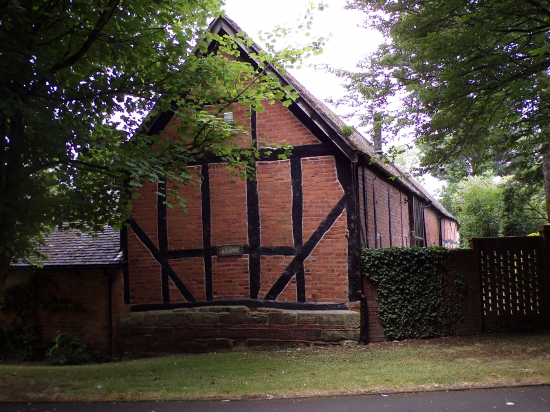
Entry Name: The Old Barn
Listing Date: 28 April 1952
Last Amended: 1 November 1972
Grade: II
Source: Historic England
Source ID: 1348488
English Heritage Legacy ID: 155730
ID on this website: 101348488
Location: Stoney Hill, Bromsgrove, Worcestershire, B60
County: Worcestershire
District: Bromsgrove
Electoral Ward/Division: Bromsgrove Central
Parish: Non Civil Parish
Built-Up Area: Bromsgrove
Traditional County: Worcestershire
Lieutenancy Area (Ceremonial County): Worcestershire
Church of England Parish: Bromsgrove
Church of England Diocese: Worcester
Tagged with: Agricultural structure
This list entry was subject to a Minor Amendment on 27 February 2024 to amend the name and address and reformat the text to current standards
SO 96 NE
6/87
ASTON WIELDS
HARVINGTON ROAD,
The Old Barn
(Formemrly listed as OLD STATION ROAD, Farm buildings to West of No 80)
GV
II
C17 farm buildings of heavy timber framing with red brick nogging. Machine tile roof with gable ends. Included for group value.
No 80 and Farm buildings to east form a group.
Listing NGR: SO9619869917
External links are from the relevant listing authority and, where applicable, Wikidata. Wikidata IDs may be related buildings as well as this specific building. If you want to add or update a link, you will need to do so by editing the Wikidata entry.


Other nearby listed buildings