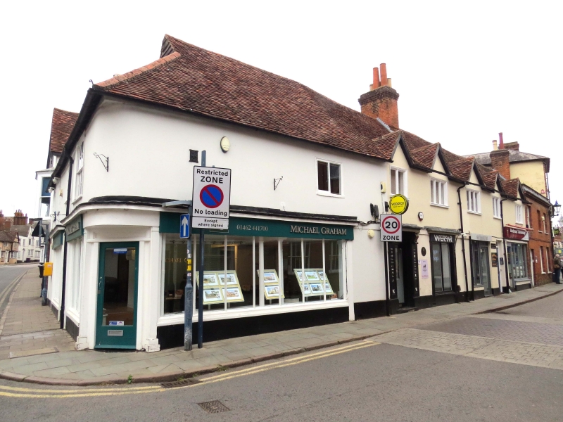
Latitude: 51.9461 / 51°56'46"N
Longitude: -0.2797 / 0°16'46"W
OS Eastings: 518335
OS Northings: 228914
OS Grid: TL183289
Mapcode National: GBR H5W.VH5
Mapcode Global: VHGNS.3BGX
Plus Code: 9C3XWPWC+F4
Entry Name: 20-22, Bucklersbury
Listing Date: 17 June 1974
Grade: II
Source: Historic England
Source ID: 1347564
English Heritage Legacy ID: 161459
ID on this website: 101347564
Location: Hitchin, North Hertfordshire, SG5
County: Hertfordshire
District: North Hertfordshire
Electoral Ward/Division: Hitchin Highbury
Parish: Non Civil Parish
Built-Up Area: Hitchin
Traditional County: Hertfordshire
Lieutenancy Area (Ceremonial County): Hertfordshire
Church of England Parish: Hitchin
Church of England Diocese: St.Albans
Tagged with: Building
1. 5255 BUCKLERSBURY (Weat Side) Nos 20 to 22 (consec) TL 1828 NW 2/226
IT GV
2. C17 or earlier, altered C19. Stucco faced ground. floor, timber framed and plastered first floor. Old tiled roof. 2 storeys, 6 first moor casement windows. C19 shop windows with Doric pilasters. Doorhood on console brackets to No 20.
Nos 20 to 34 (consec) form a group.
Listing NGR: TL1833528914
External links are from the relevant listing authority and, where applicable, Wikidata. Wikidata IDs may be related buildings as well as this specific building. If you want to add or update a link, you will need to do so by editing the Wikidata entry.


Other nearby listed buildings