Latitude: 52.0075 / 52°0'26"N
Longitude: -0.039 / 0°2'20"W
OS Eastings: 534696
OS Northings: 236153
OS Grid: TL346361
Mapcode National: GBR K88.2Z6
Mapcode Global: VHGNJ.8SRY
Plus Code: 9C4X2X46+XC
Entry Name: Holborn Farm House
Listing Date: 29 January 1986
Grade: II
Source: Historic England
Source ID: 1347386
English Heritage Legacy ID: 162431
ID on this website: 101347386
Location: Reed End, North Hertfordshire, SG8
County: Hertfordshire
District: North Hertfordshire
Civil Parish: Therfield
Traditional County: Hertfordshire
Lieutenancy Area (Ceremonial County): Hertfordshire
Church of England Parish: Therfield
Church of England Diocese: St.Albans
Tagged with: Farmhouse
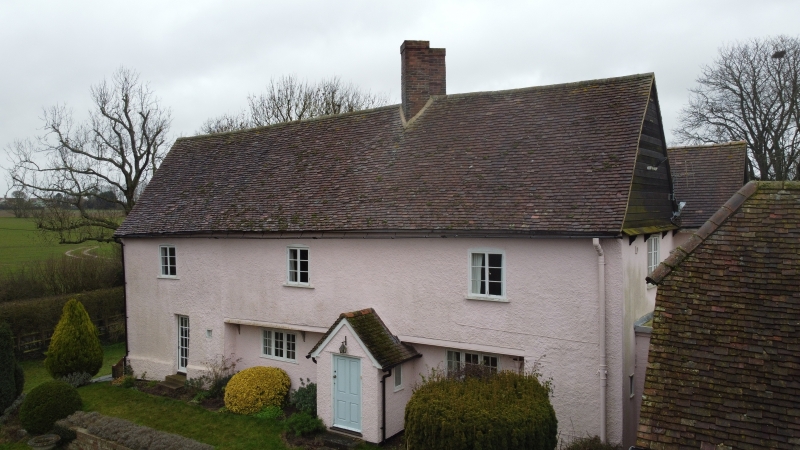
THERFIELD DANE END TL 33 NW (East side) 4/108 Holborn Farm House GV II House. Late C16 or early C17, altered C19, extended C20. Timber frame, roughcast. Steeply pitched tiled roof. Originally broad 3 cell lobby entry. 2 storeys. Projecting gabled entrance porch to right of centre with flanking 3 light small pane flush frame casements, second entrance to left. First floor jettied with curved brackets, underbuilt at both ends. Three 2 light casements with cambered heads on first floor, cross axial ridge stack rebuilt as original with 2 diagonal flues. Rendered left end with a ground floor 2 light casement, weatherboarded attic. Right end first floor 2 light casement, weatherboarded attic. 1 storey C20 outshut to right links to earlier outbuilding, weatherboarded with steeply pitched half hipped tiled roof. 2 bays. Double doors and a smaller door to front. Interior not inspected. C20 addition to rear of no special interest.
Listing NGR: TL3469636153
External links are from the relevant listing authority and, where applicable, Wikidata. Wikidata IDs may be related buildings as well as this specific building. If you want to add or update a link, you will need to do so by editing the Wikidata entry.


Other nearby listed buildings