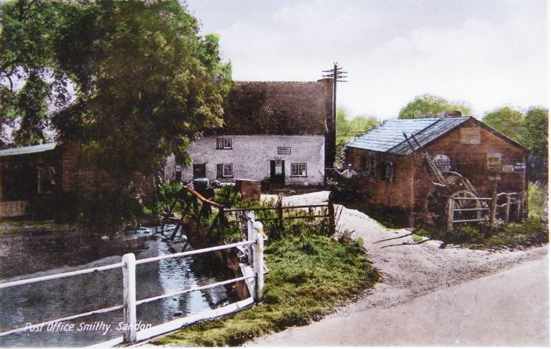
Latitude: 51.9925 / 51°59'32"N
Longitude: -0.0767 / 0°4'36"W
OS Eastings: 532153
OS Northings: 234418
OS Grid: TL321344
Mapcode National: GBR K8D.5FD
Mapcode Global: VHGNP.M5BW
Plus Code: 9C3XXWRF+X8
Entry Name: The Forge
Listing Date: 29 January 1986
Grade: II
Source: Historic England
Source ID: 1347384
English Heritage Legacy ID: 162414
ID on this website: 101347384
Location: Sandon, North Hertfordshire, SG9
County: Hertfordshire
District: North Hertfordshire
Civil Parish: Sandon
Traditional County: Hertfordshire
Lieutenancy Area (Ceremonial County): Hertfordshire
Church of England Parish: Sandon
Church of England Diocese: St.Albans
Tagged with: Smithy
SANDON RUSHDEN ROAD TL 33 SW (Southeast side) Sandon 7/91 The Forge GV II House. C17, altered C20. Timber frame on brick base, roughcast with some brick alterations. Tiled roof. 3 cell lobby entry. 2 storeys. Entrance between left and centre bays in C20 gabled porch. Second entrance in right bay. All windows are horizontal sliding sashes except a C20 casement to left on ground floor. Rebuilt ridge stack. Right gable end ground floor lean-to outshut, first floor horizontal sliding sash, exposed plates and purlins, bargeboards. C20 1 storey outshut on left end. To rear: ground floor brick casing, C20 casements, 2 gabled dormers.
Listing NGR: TL3215334418
External links are from the relevant listing authority and, where applicable, Wikidata. Wikidata IDs may be related buildings as well as this specific building. If you want to add or update a link, you will need to do so by editing the Wikidata entry.


Other nearby listed buildings