Latitude: 53.7457 / 53°44'44"N
Longitude: -0.8677 / 0°52'3"W
OS Eastings: 474772
OS Northings: 428302
OS Grid: SE747283
Mapcode National: GBR QTC3.YZ
Mapcode Global: WHFDC.N30S
Plus Code: 9C5XP4WJ+7W
Entry Name: 64, Bridgegate
Listing Date: 16 December 1966
Last Amended: 15 September 1987
Grade: II
Source: Historic England
Source ID: 1346734
English Heritage Legacy ID: 165325
ID on this website: 101346734
Location: Howden, East Riding of Yorkshire, DN14
County: East Riding of Yorkshire
Civil Parish: Howden
Built-Up Area: Howden
Traditional County: Yorkshire
Lieutenancy Area (Ceremonial County): East Riding of Yorkshire
Church of England Parish: Howden with Barmby on the Marsh
Church of England Diocese: York
Tagged with: Building
HOWDEN BRIDGEGATE SE 7428 (south-west side)
12/97 No 64 (formerly listed as 16.12.66 64, St Helen's Square)
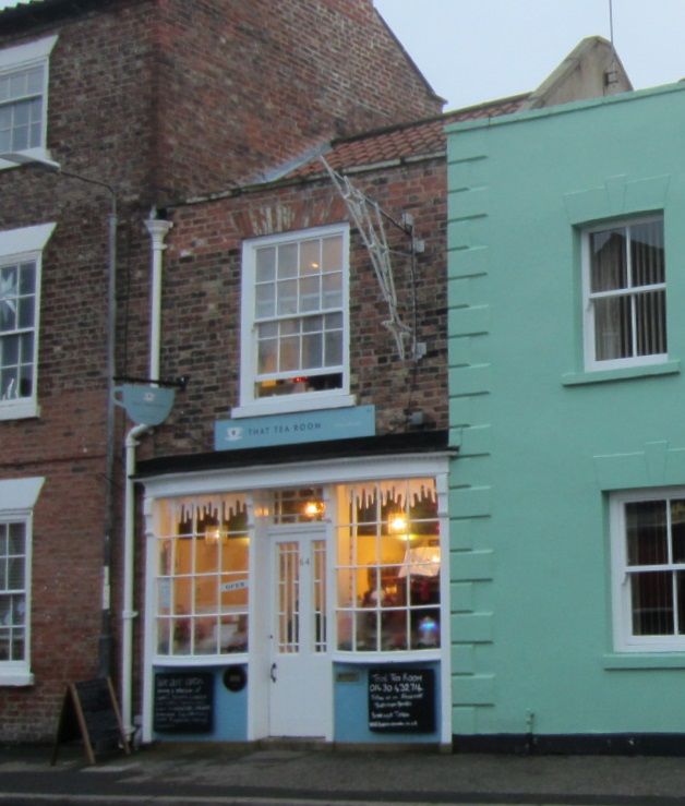
GV II Shop. Late C18 - early C19 with earlier origins and C20 restoration. Brick in Flemish bond, pantile roof. 2 storeys, one bay. C20 shop front, replicating C19 original, has central half-glazed door with overlight flanked by bow windows, all articulated by reeded pilasters carrying frieze. First floor: 16-pane sash beneath flat brick arch. Blind coped parapet. Pitched roof. Interior: bakehouse to rear of property contains sub-floor water cistern of early C18, and C19 cast-iron oven. Late C18 hob grate to rear office. Neave D, Howden Explored, 1979.
Listing NGR: SE7477128303
External links are from the relevant listing authority and, where applicable, Wikidata. Wikidata IDs may be related buildings as well as this specific building. If you want to add or update a link, you will need to do so by editing the Wikidata entry.


Other nearby listed buildings