Latitude: 53.0269 / 53°1'36"N
Longitude: -1.4804 / 1°28'49"W
OS Eastings: 434945
OS Northings: 347857
OS Grid: SK349478
Mapcode National: GBR 6CP.BJP
Mapcode Global: WHDGF.759W
Plus Code: 9C5W2GG9+PR
Entry Name: 38-47, Short Rows
Listing Date: 13 December 1979
Grade: II
Source: Historic England
Source ID: 1346572
English Heritage Legacy ID: 78610
ID on this website: 101346572
Location: Belper, Amber Valley, Derbyshire, DE56
County: Derbyshire
District: Amber Valley
Civil Parish: Belper
Built-Up Area: Belper
Traditional County: Derbyshire
Lieutenancy Area (Ceremonial County): Derbyshire
Church of England Parish: Belper St Peter
Church of England Diocese: Derby
Tagged with: Building
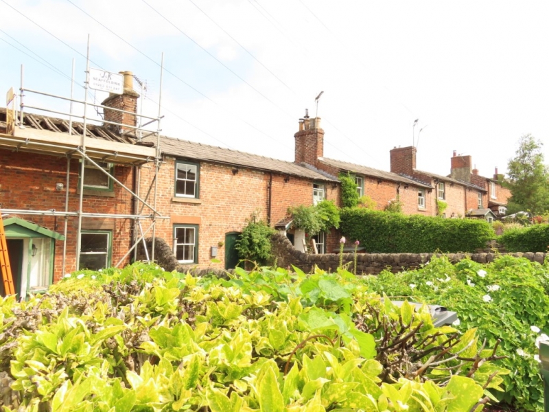
SHORT ROWS 1. 5167 Nos 38 to 47 (consec) SK 3447 NE 1/78 II GV 2. The houses on Short Row are probably the first built by the Strutts in Belper. Erected between 1788 and the early 1790s. Terraced cottages stepped up hillside in pairs. Red brick, slate roof. Two storeys. One window each, most modern glazing in former window spaces.
Listing NGR: SK3494547857
External links are from the relevant listing authority and, where applicable, Wikidata. Wikidata IDs may be related buildings as well as this specific building. If you want to add or update a link, you will need to do so by editing the Wikidata entry.


Other nearby listed buildings