Latitude: 51.185 / 51°11'6"N
Longitude: -3.4536 / 3°27'12"W
OS Eastings: 298503
OS Northings: 143869
OS Grid: SS985438
Mapcode National: GBR LK.5NWM
Mapcode Global: VH6GM.3G2X
Plus Code: 9C3R5GPW+2H
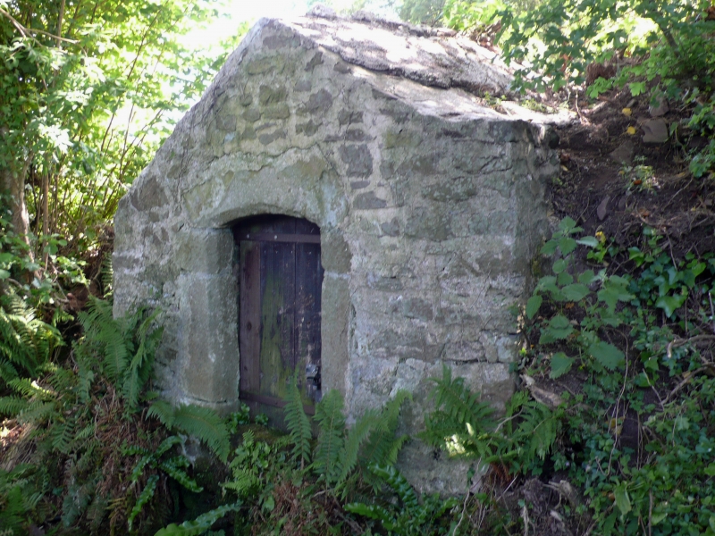
Entry Name: Well Head over St Leonard's Well
Listing Date: 6 November 1975
Grade: II
Source: Historic England
Source ID: 1345612
English Heritage Legacy ID: 264666
ID on this website: 101345612
Location: Dunster, Somerset, TA24
County: Somerset
District: Somerset West and Taunton
Civil Parish: Dunster
Traditional County: Somerset
Lieutenancy Area (Ceremonial County): Somerset
1.
5366 DUNSTER CONDUIT LANE
Well-head over St Leonard's Well
SS 9843-9943 4/34 6.11.75
II
2.
Probably of 16th century origin. Rubble, rectangular on plan, cemented roof.
Chamfered freestone opening on Lane with segmental head, plain wooden door.
Listing NGR: SS9850343869


Other nearby listed buildings