Latitude: 51.042 / 51°2'31"N
Longitude: -3.3119 / 3°18'42"W
OS Eastings: 308125
OS Northings: 127783
OS Grid: ST081277
Mapcode National: GBR LR.GNSG
Mapcode Global: FRA 36YC.HKN
Plus Code: 9C3R2MRQ+R7
Entry Name: Berrys
Listing Date: 26 March 1984
Grade: II
Source: Historic England
Source ID: 1344831
English Heritage Legacy ID: 270146
ID on this website: 101344831
Location: Wiveliscombe, Somerset, TA4
County: Somerset
District: Somerset West and Taunton
Civil Parish: Wiveliscombe
Built-Up Area: Wiveliscombe
Traditional County: Somerset
Lieutenancy Area (Ceremonial County): Somerset
Tagged with: Building
ST0827 WIVELISCOMBE CP HIGH STREET (East side)
8/70 No 5 (Berrys)
-
GV II
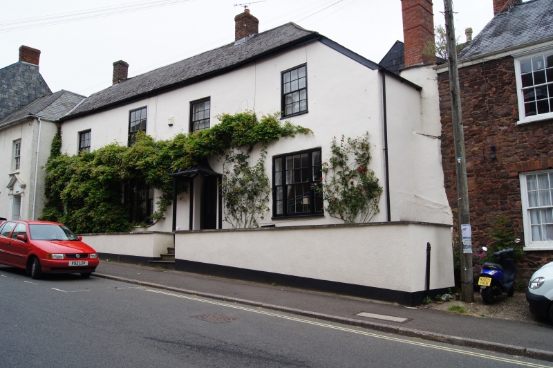
House. Circa 1700 with later alterations. Rendered, Welsh slate roof hipped to right, brick stack to left of cross-passage. 2-storeys and 4-bays. Windows of varying sizes irregularly placed, sashes with glazing bars, tripartite flanking entrance. Early C19 lead canopied porch on wooden supports approached by short flight of stone stairs, C20 door.
Listing NGR: ST0812527783
External links are from the relevant listing authority and, where applicable, Wikidata. Wikidata IDs may be related buildings as well as this specific building. If you want to add or update a link, you will need to do so by editing the Wikidata entry.


Other nearby listed buildings