Latitude: 51.2618 / 51°15'42"N
Longitude: 0.6255 / 0°37'31"E
OS Eastings: 583276
OS Northings: 154679
OS Grid: TQ832546
Mapcode National: GBR QSP.WF6
Mapcode Global: VHJMG.SKJ1
Plus Code: 9F327J6G+P5
Entry Name: Niton House
Listing Date: 21 October 1986
Grade: II
Source: Historic England
Source ID: 1344339
English Heritage Legacy ID: 174363
ID on this website: 101344339
Location: Eyhorne Street, Maidstone, Kent, ME17
County: Kent
District: Maidstone
Civil Parish: Hollingbourne
Traditional County: Kent
Lieutenancy Area (Ceremonial County): Kent
Tagged with: House
HOLLINGBOURNE EYHORNE STREET TQ 8354 (North Side) 9/135 No. 15 (Niton House)
GV II
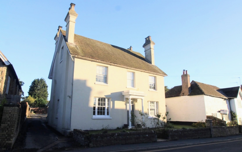
House. Early-to-Mid C19. Channelled render, with plain tile roof. Double depth. 2 storeys and garret. Projecting eaves to gable ends, with moulded bargeboards. Slightly projecting rendered, corniced stack towards front and rear of each gable end. Regular 3-window front of recessed 16-pane sashes. Tripartite ground-floor windows. Central pannelled door with rectangular fanlight. Corniced Doric porch. Interior not inspected. Included for group value.
Listing NGR: TQ8327654679
External links are from the relevant listing authority and, where applicable, Wikidata. Wikidata IDs may be related buildings as well as this specific building. If you want to add or update a link, you will need to do so by editing the Wikidata entry.


Other nearby listed buildings