Latitude: 51.2094 / 51°12'33"N
Longitude: 0.6028 / 0°36'9"E
OS Eastings: 581899
OS Northings: 148792
OS Grid: TQ818487
Mapcode National: GBR QTF.376
Mapcode Global: VHJMN.DVJS
Plus Code: 9F326J53+P4
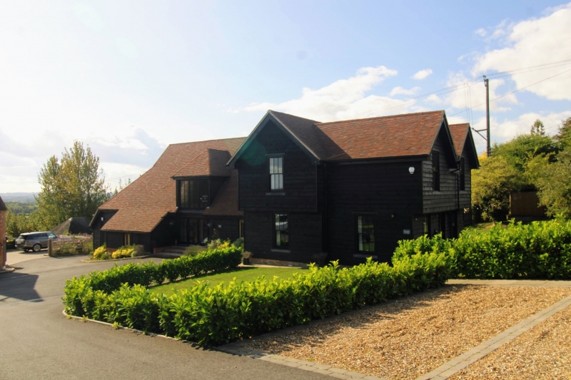
Entry Name: Barn About 36 Metres East South East of Stallance
Listing Date: 18 December 1985
Grade: II
Source: Historic England
Source ID: 1344324
English Heritage Legacy ID: 174178
ID on this website: 101344324
Location: The Harbour, Maidstone, Kent, ME17
County: Kent
District: Maidstone
Civil Parish: Sutton Valence
Traditional County: Kent
Lieutenancy Area (Ceremonial County): Kent
Tagged with: Barn
SUTTON VALENCE RECTORY LANE TQ 819 488 5/157 Barn about 36 metres east-south- east of Stallance GV II
Barn. Early-to-mid C17. Timber framed, weatherboarded, on stone plinth with hipped C20 plain tile roof. 3 timber-framed bays, aisled front and rear, truncated to right. Central double doors with flat-topped canopy. Lean-to in front of aisle to left of doors. Lean-to to left end. Interior: arch-braced posts with cut jowls. Curved passing shores to aisles. Clasped purlin roof with diminishing principal rafters, imtermediate collars and almost straight windbraces. Addition to right not included.
Listing NGR: TQ8184248810
External links are from the relevant listing authority and, where applicable, Wikidata. Wikidata IDs may be related buildings as well as this specific building. If you want to add or update a link, you will need to do so by editing the Wikidata entry.


Other nearby listed buildings