Latitude: 51.3182 / 51°19'5"N
Longitude: 0.8934 / 0°53'36"E
OS Eastings: 601723
OS Northings: 161651
OS Grid: TR017616
Mapcode National: GBR SW3.BPD
Mapcode Global: VHKJW.F4P9
Plus Code: 9F328V9V+79
Entry Name: 14, Abbey Street
Listing Date: 4 May 1970
Grade: II
Source: Historic England
Source ID: 1344230
English Heritage Legacy ID: 175827
ID on this website: 101344230
Location: Faversham, Swale, Kent, ME13
County: Kent
District: Swale
Civil Parish: Faversham
Built-Up Area: Faversham
Traditional County: Kent
Lieutenancy Area (Ceremonial County): Kent
Tagged with: Inn
This list entry was subject to a Minor Amendment on 10 April 2025 to update the Name and Address and reformat the text to current standards
TR 0161 NE
1/76
ABBEY STREET (West Side)
No 14
(Formerly listed as No 14 [The King's Head Inn])
4.5.70.
GV
II
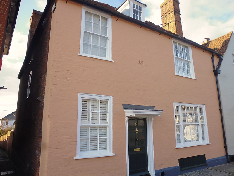
C18. Two storeys and attic. Two windows. One hipped dormer. Painted brick. Steeply pitched hipped tiled roof. Glazing bars intact except in one ground floor modern window. Doorway with pilasters, flat hood on brackets and six-panel door.
Nos 14 to 32 (consec) form a group.
Listing NGR: TR0172161652
External links are from the relevant listing authority and, where applicable, Wikidata. Wikidata IDs may be related buildings as well as this specific building. If you want to add or update a link, you will need to do so by editing the Wikidata entry.


Other nearby listed buildings