Latitude: 51.079 / 51°4'44"N
Longitude: 1.1825 / 1°10'56"E
OS Eastings: 623013
OS Northings: 135892
OS Grid: TR230358
Mapcode National: GBR W21.CRJ
Mapcode Global: FRA F6C8.GJ1
Plus Code: 9F3335HJ+HX
Entry Name: Priory House
Listing Date: 11 March 1975
Grade: II
Source: Historic England
Source ID: 1344126
English Heritage Legacy ID: 175262
ID on this website: 101344126
Location: Folkestone, Folkestone and Hythe, Kent, CT20
County: Kent
District: Folkestone and Hythe
Civil Parish: Folkestone
Built-Up Area: Folkestone
Traditional County: Kent
Lieutenancy Area (Ceremonial County): Kent
Tagged with: House
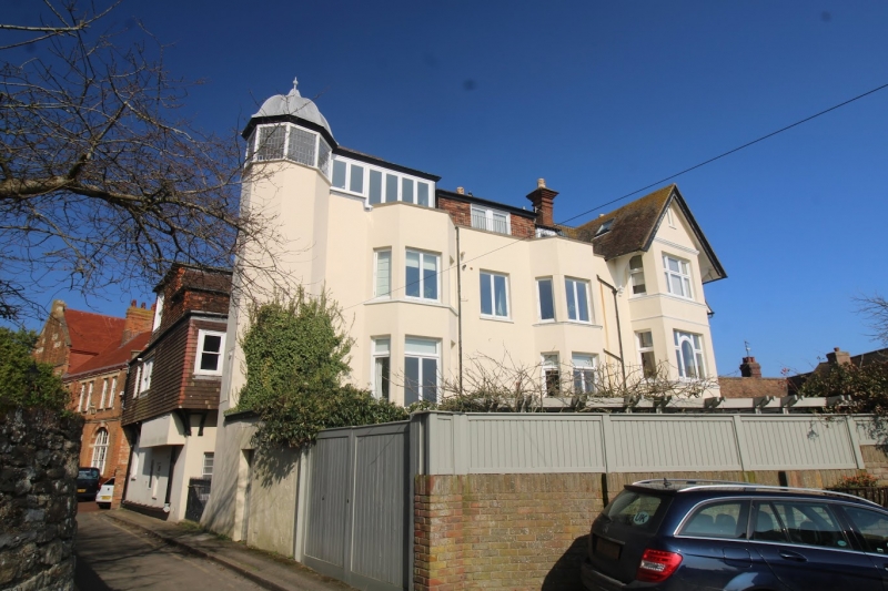
1. 5281 THE BAYLE (South Side) FOLKESTONE 'Priory House' TR 2235 NE 1/5A TR 2335 NW 2/5A II GV 2. C18 and later. The main part is of 3 storeys stone rubble with white brick dressings. Hipped tiled roof and parapet. 3 modern casement windows but the ground floor has 2 triple sashes with glazing bars intact. Doorcase in cemented surround with flat hood on brackets and 6 fielded panelled door. The right side elevation has modern tile hanging on the upper floors, and an overhang supported on wooden brackets. On the right hand corner of this elevation is a late C19 cemented octagonal tower with cupola. To the extreme left of the front elevation is a 3 storey portion of higher elevation than the rest with a gable hung with curved tiles.
Priory House and Nos 4 to 18 (even) form a group.
Listing NGR: TR2301335892
External links are from the relevant listing authority and, where applicable, Wikidata. Wikidata IDs may be related buildings as well as this specific building. If you want to add or update a link, you will need to do so by editing the Wikidata entry.


Other nearby listed buildings