Latitude: 51.3294 / 51°19'45"N
Longitude: 0.8427 / 0°50'33"E
OS Eastings: 598142
OS Northings: 162761
OS Grid: TQ981627
Mapcode National: GBR RTJ.PVC
Mapcode Global: VHKJN.KVD7
Plus Code: 9F328RHV+Q3
Entry Name: The Mounted Rifleman
Listing Date: 21 May 1986
Grade: II
Source: Historic England
Source ID: 1344017
English Heritage Legacy ID: 176771
ID on this website: 101344017
Location: Swale, Kent, ME13
County: Kent
District: Swale
Civil Parish: Luddenham
Traditional County: Kent
Lieutenancy Area (Ceremonial County): Kent
Tagged with: Architectural structure
TQ 96 SE LUDDENHAM + OARE ELVERTON
1/167 The Mounted Rifleman
II
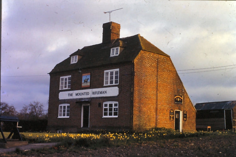
Public House. C18. Red and blue chequered brick and plain tiled roof. Two storeys and attic with basement. Plinth and corbelled brick eaves cornice to half-hipped roof with 2 hipped dormers and central stack. Two wooden casements on each floor, those on ground floor with segmental heads, and central door of 4 panels with flat hood. Basement opening to left.
Listing NGR: TQ9814262761
External links are from the relevant listing authority and, where applicable, Wikidata. Wikidata IDs may be related buildings as well as this specific building. If you want to add or update a link, you will need to do so by editing the Wikidata entry.


Other nearby listed buildings