Latitude: 51.3112 / 51°18'40"N
Longitude: 0.8764 / 0°52'35"E
OS Eastings: 600566
OS Northings: 160831
OS Grid: TR005608
Mapcode National: GBR SW3.LDX
Mapcode Global: VHKJW.49PN
Plus Code: 9F328V6G+FH
Entry Name: The Mount
Listing Date: 3 August 1972
Grade: II
Source: Historic England
Source ID: 1343843
English Heritage Legacy ID: 175929
ID on this website: 101343843
Location: Ospringe, Swale, Kent, ME13
County: Kent
District: Swale
Civil Parish: Faversham
Built-Up Area: Faversham
Traditional County: Kent
Lieutenancy Area (Ceremonial County): Kent
Tagged with: Architectural structure
LONDON ROAD 1. ----------- 1103 The Mount TR 0060 11/168 II
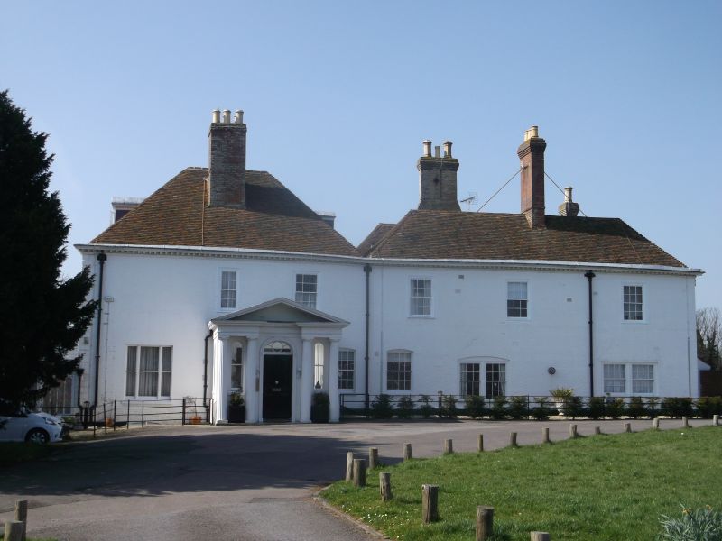
2. Formerly, the Office of the Ministry of National Insurance and the County Agricultural Emergency Committee. C18. The main front faces south. 2 storeys and attic. 5 windows. 3 dormers. Brick, painted. Brick stringcourse. Wooden modiliion eaves cornice. Tiled roof. The dormer windows are surmounted by pediments, the centre one triangular, the outer ones curved. Glazing bars missing. The whole of the ground floor is hidden by Victorian glass conservatory which extends the whole width of the south front. The east front has 5 Windows and porch originally with 2 pairs of fluted Doric columns, although end pair is now missing; pediment, round-headed doorway with semi-circular fanlight and 2 narrow round-headed lights flanking it between the columns.
Listing NGR: TR0056660831
External links are from the relevant listing authority and, where applicable, Wikidata. Wikidata IDs may be related buildings as well as this specific building. If you want to add or update a link, you will need to do so by editing the Wikidata entry.


Other nearby listed buildings